It's been a while since Iv'e been on a mountain biking road trip & I have a game plan to bag as many munros (mountains) as I can by bike so with a weeks holiday from work I decided to add another munro to the 'bagged' list.
My chosen munro today was Ben Chonzie located in Perthshire, not the most dramatic of the listed 282 Scottish munros as it's mainly a rocky track which then leads onto a boggy moorland trail ending up onto a fairly flat plateau at the summit all easily navigated & that's my reason for choosing this mountain as I could cycle a good way before hike'a'bike to the top & then I could enjoy the hard work of getting there by a high speed blast back down again.
Loading up the van with my bike gear & armed with a travel mug of hot coffee I set off for a two hour drive looking forward to the day ahead.
My chosen munro today was Ben Chonzie located in Perthshire, not the most dramatic of the listed 282 Scottish munros as it's mainly a rocky track which then leads onto a boggy moorland trail ending up onto a fairly flat plateau at the summit all easily navigated & that's my reason for choosing this mountain as I could cycle a good way before hike'a'bike to the top & then I could enjoy the hard work of getting there by a high speed blast back down again.
Loading up the van with my bike gear & armed with a travel mug of hot coffee I set off for a two hour drive looking forward to the day ahead.

Alarm set for 04:50 & on my way by 05:30 to miss the rush hour traffic.


Arriving at Invergeldie at 07:30 to a nice fresh damp morning with the promise of some good weather, I eagerly unloaded the bike from the van & set off up the track on my climb to bag Ben Chonzie.


Rounding a hill I had my first view of Ben Chonzie which had a dusting of overnight snow & the very top kept disappearing in the cloud.


Looking back behind me I had already gained some good height using very little energy on the steady climb up the track.
Every time I go on a road trip I always check for geocaches on my chosen route, today there were a few to collect, I programme the geocache co-ordinates into my GPS device which then alert me when I'm near a cache, the alarm sounded to say one was near by which I found & signed the log book then replacing the cache back in it's hiding place ready for the next geocacher to find.
Foolishly I never checked the battery life in my GPS device & no sooner had I found the first cache the low battery alarm sounded & the screen went blank...! I have a bad habit of not checking or re-charging batteries...doh !


Proceeding onwards I follow the track to the right.


Arriving at the Invergeldie dam, stopping for a look around the water was crystal clear & deep, if it was the hot summer months I would of definitely jumped in for a swim on way back down off the mountain.


Another route choice, this time taking the track to the left.
The Invergeldie dam was almost invisible from here.


The gradient of the road was forever getting steeper, a good excuse to stop from time to time to soak up these amazing views.


The road ahead twisting & snaking it's way upwards with a hill burn flowing downstream to my left which then flows into the Invergeldie burn.


The rocky track was starting to get much steeper & a lot of effort was involved to keep traction, near enough every turn of the pedals resulted in the back wheel dislodging the loose rocks from their resting place causing the wheel to spin.

Ben Vorlich far in the distance shrouded in cloud, 985 metres - 3232 feet high & the 165 highest munro in Scotland.


Slow going but with a back drop like that it was enjoyable none the less.



The sun was starting to make more of an appearance breaking through the grey clouds & I arrived in the snow zone, still some deep patches here & there where the sun doesn't really get to.


The end of the rocky track for now, it continues to the right but my route switches to the left onto a single track.

Which turned out to be a thick gloopy bog.


The temperature was notably a lot colder up here in the snow zone.


With the dusting of snow the trail kept disappearing now & then but I knew roughly which way to head, now if I'd been a bit more on the ball & checked the batteries in my GPS device I wouldn't of had any trouble finding the trail :-/


The wind was really picking up as I gained altitude & there were threatening dark clouds gathering so I was expecting snow or rain but luckily they passed over in no time.


Arriving at the metal fence posts I knew I hadn't too far to go now. You can follow them all the way to the top but I followed them so far up then took a walkers trail diagonally which shortens the distance a good bit.


It was really freezing now the wind was howling, the left side of my face was numb & I couldn't feel my fingers they were so cold it felt like proper mountain weather.
I foolishly left my gloves in the van by mistake..!


I was chuffed to bits to spot a mountain hare in his white winter coat.


Nearly at the top now on the plateau & I took refuge for five minutes to get a break from the howling wind behind a stone grouse butt, you can see how cold it was on the north westerly side of the grouse butt has ice crystals on it.


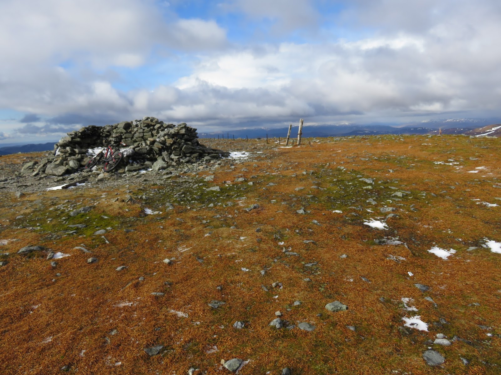
Onwards & upwards I finally spied the cairn at the summit & another example of how cold it was the wind & ice blasted fence post.


Ben Chonzie...bagged :-)
Scotlands 250th highest munro standing tall at 931 metres - 3054 feet.


From here at the summit I had a great view down onto Loch Turret reservoir. I plan to come back & do this mountain again some day but starting from the dam end of Loch Turret where a track follows the loch edge then there's a track up here to Ben Chonzie from here you can follow a circular loop across to Meall na Seide then onto Carn Chois then finally head back down to the dam end to finish the loop.
But when I do it I'll make sure the weather is warmer !


Views from the summit looking North, South, East & West.
I wish I had a better knowledge of the surrounding mountain peaks.

After grabbing a quick few pictures it was time to get off this summit plateau. I'm not one for really feeling the cold but up here I was absolutely freezing & foolishly under dressed for mountain top weather, the wind chill had to of been in the minus double figures so I didn't hang around as long as I wanted to.


On the way down I spooked another mountain hare who took off so fast & was gone out of sight by the time I got my camera out of my pocket but here are it's footprints from where it was sitting.


The biggest highlight of my day apart from bagging the munro was seeing this ptarmigan, it's the first one I've ever seen in the wild & it had no fear of me what so ever, it just stood there around 5 yards away & was quite happy for me to sit down & take a few pictures. It's moments like this that are special & make it all worth while. I was amazed at how it did not see me as a threat just like the snow buntings I saw at the top of BenMcDui but it may have never seen a human before so has nothing to be afraid off :-/

My tracks on the way there...

...my tracks there & back again.


I was glad to be back on the southern slopes again out of that intense cold & wind where I gradually thawed out & started getting feeling back in my hands & face.


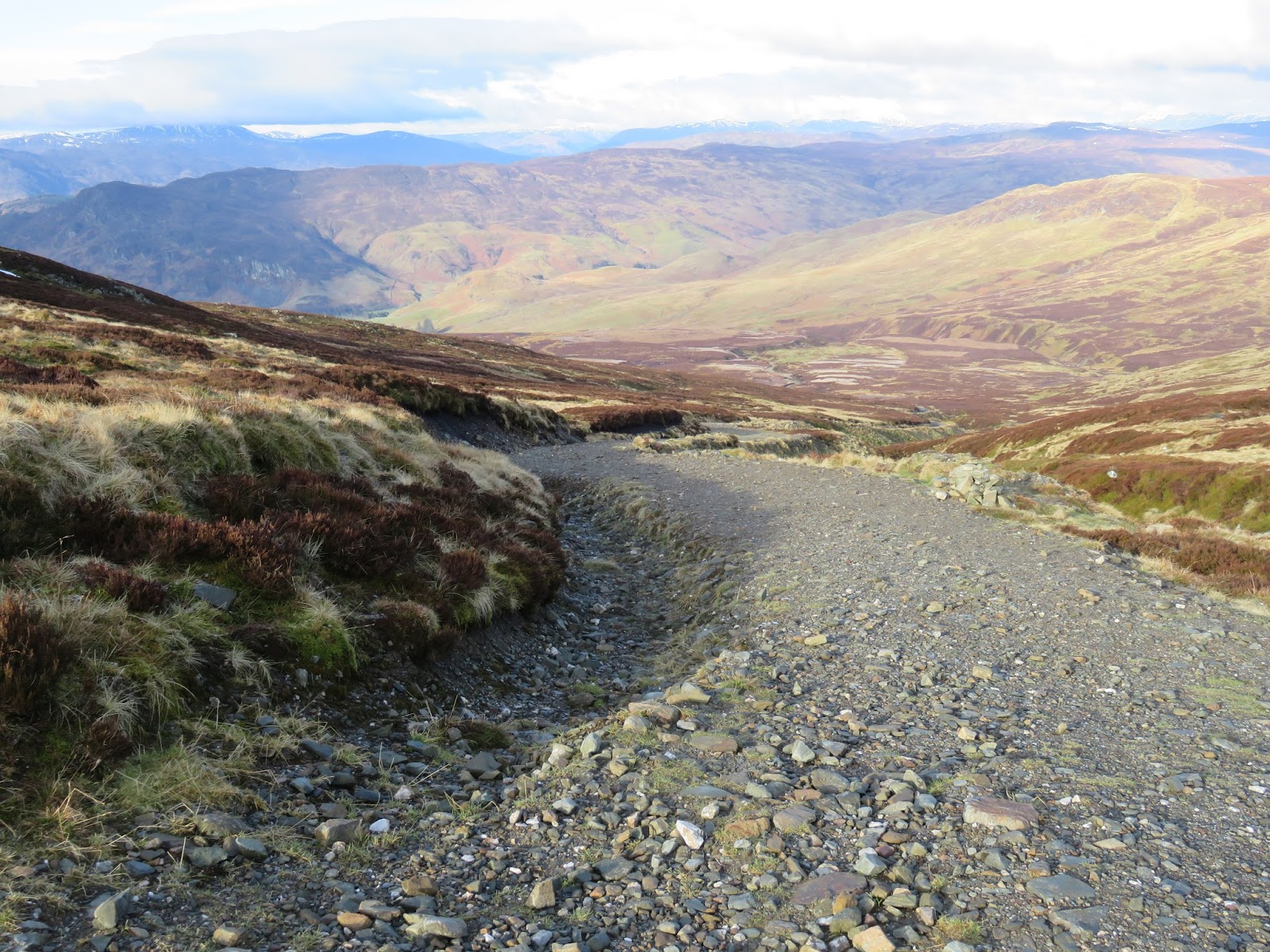
Downwards through the boggy ramblers trail & you can see on the above picture the rocky track that I'd soon be back onto.


I was not the only one up here, earlier in the morning I met a hill runner on his way down as I was on my way up & I passed about a dozen walkers on their way up as I was on my way down.
I had a funny moment when I was heading down I was going that fast that I surprised a couple, the guy saw me & I saw him say something to a women crouching down behind a small hill then he manoeuvred himself to try hiding her dignity while she was sqatting doing a pee, I said hello but got a frosty stare & no return acknowledgement back from him heh heh, when you've got to go you've got to go :-/ either that or he was one of those fanatical hill walkers who think mountain bikers are just hooligans of the countryside !...


...anyway back to the story.
The downhill ride back down the rocky track was awesome, really fast & you had to have your wits about you to negotiate the boulder strewn track then disaster struck...
...as I was bombing down giving it what for a boulder flicked up smashing into my shin then proceeded to find it's way into my rear wheel breaking four spokes, three together & one a couple of spokes further back, I was gutted, for now I had to gently nurse my way back down slowly for the fear of doing more damage to the wheel :-( I was more bothered about my poor bike than my leg which looked like the Forth rail bridge with two huge lumps poking out.


I still had a fair distance to go so I was cheesed off to say the least after all the hard work put in getting up there for the joyous high speed return down again.
Never mind now I have two reasons to come back again,
-
1/ To collect the geocaches I never got.
&
2/ To come back down this road again at warp speed !


Passing the oddest looking cockerel I've ever seen I was soon back at the van energised after my eventful adventure.

Gutted !
Thanks for viewing & I hope you enjoyed the trip.
Follow me on Twitter - MTB Stravaiger@MoontanBiker
or check out my
Facebook page- Mtb Innerwick Stravaiger (Blogger)
for all the recent blog updates.
Thanks again & keep the pedals turning.


