This is a nice little cross border jaunt from East Lothian into Berwickshire along roads, tracks, trails & from coast to country passing by the villages & hamlets of Dunglass estate, Cove & Cove harbour, Pease bay, Cockburnspath, Oldhamstocks, Stottencleugh & Cocklaw.


The route sign for linking Oldhamstocks to Dunglass estate via an off road track.

A waymark arrow.


The field side track heading towards Dunglass estate.

The end of the trail approx 1-1/2 mile in distance.

Dunglass estate house.

The date of the building the chapel dedicated to St. Mary of Dunglass is unclear, But the chapel was in existence in 1423. The college was composed of a provost, 3 chaplains & 4 boy choiristers, The church consisted of a nave, a choir & the home burial vault. In 1544 the church was attacked by the Earl of Hertford's army during the wars of the 'Rough Wooing' but the locals managed to repel the insurgents. In 1560 the church closed at the onset of the Scottish Reformation.

Dunglass mill cottage by the sea.

The entrance down to the Cove Harbour.

Information board telling the history of the harbour.


A memorial dedicated to the fishermen & their family's of whom the fishermen lost their lives at sea in 1881.


The famous Cove cottage used in many t.v. programmes, films & commercials, Now used by local fishermen for a workshop & store.


Holiday cottage on the beach side of the harbour note the landslide on the hillside.

A cave cut through the cliff to reach the beach side of the harbour. The Cove has a history of smugglers caves.


Cove harbour from above on the Southern Upland Way trail.

Southern Upland Way marker post.


Cove harbour & behind to the left LaFarge cement works & to the right Torness nuclear power station.

Surfers down at Pease Bay a hotspot for surfer dudes.

Steps leading down to Pease Bay.


The church at the centre of the village of Cockburnspath, It has four singular features: The round tower, the bell, the burial aisle & the sundial, The distinctive round tower was added in approx 1650 & the height increast by 12 ft in 1827 on the suggestion of Lady Dunglass. The present fine toned bell was a gift in 1837 from the Broadwood family once proprietors of Fulfordlees, although a bell is recorded as having been in place as early as 1644. Theburial aisle is at the east end of the church it was built by the Laird William Arnot in 1614 & kept in repairs by his successor Sir William Nicholson who reserved it for his family. The sundial is on the south west corner of the church & therefore able to give afternoon times. A new vestry was built in 2003.

Back in my home county.

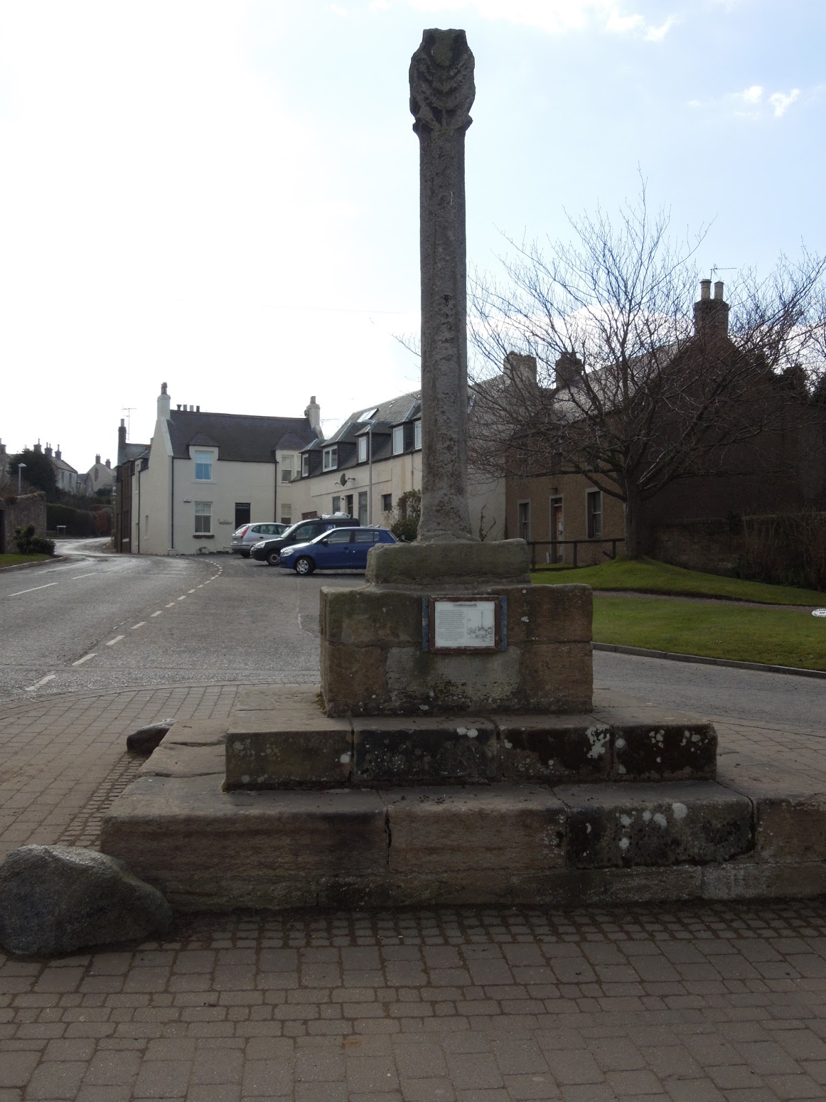
The market cross of Oldhamstocks was removed before 1900, the shaft at that time being preserved in the manse gardens. Oldhamstocks was given the right to a weekly market in 1627. The shaft of this cross was re-erected on a modern base on the village green, the origional site of the cross was in the north half of the manse gardens (exact site unknown) which was once part of the village green.

Heading out of the village & passing by the farms of Stottencleugh & Cocklaw heading up Blackcastle hill a look back at Oldhamstocks village.

Looking back over the Berwickshire coast.

The awful wind turbnes ruining the landscape of the Lammermuir hills here in East Lothian.


Still a fair bit of snow lying around up high in the hills.

Made it to the top, The highest point of the bike ride this is Blackcastle transmission tower.

Lafarge cement works on the east side of Dunbar, The water behind is one of the old quarry sites now returned to nature as a wildlife reserve.

My home town of Dunbar.

North Berwick law an old volcanic plug in the distance & over the Firth of Forth way in the distance are the paps of Fife.

The Bass rock another volcanic plug now home for one of the U.Ks largest Gannet colony.

A very hazey view of Traprain law.


Some Roe Deer.

The abandoned farm of Braidwood due to Torness nuclear power station being built, the farm in the way of the pylon route.

An old pig sty belonging to the farm cottages.


Some old farm machinery.

The Bass rock, Dunbar & LaFarge.

& finally a picture of an old WWII observation post which looks out over the Firth of Forth.
The end.