A couple of local fellow bloggers "Coastkid" & "Ped's outdoor diary" have both visited this real gem of a location & I just had to come for a look for myself, so with the weather looking promising with overcast skies with the occasional outbreak of sun & a temperature of 2-3 degrees it sounded like the perfect conditions, a let up in all the rain that we've had here recently, the one thing that I never checked was the tide tables & as you will see with the following photo's I should of checked ! The weather men got it wrong again about 10 minutes into my journey there was a hail shower followed by yet more rain that never stopped, but I was committed & just went for it...


Taking the high road up out of Innerwick to get the blood in the legs up to operating temperature I headed up for Branxton then to Birnie Knowes & this way avoids the dreaded cycle path which runs parallel with the A1 at a not very safe distance of about 4 feet away from the thundering traffic with no barriers ! I hate taking that route.


This is a point of the cycle where there are 4 bridges & 1 viaduct in the space of about 400-500 yards just to cross the little Dunglas burn with it's deep ravine, passing by the Dunglas bridge & under the railway viaduct.


The old A1 bridge.

A picture I found on-line of the same bridge, Dunglass burn was considered especially vulnerable, so much so that an extensive network of defences were built, the bridges crossing the burn carried the A1 & the east coast rail line, crucial arteries that would have been a tempting target for a small commando style raid. Rumour had it that there was an off-shore trench in which U-boats would lie in wait to pounce on unsuspecting ships & this would also provide the perfect position for a U-boat to wait before surfacing to send commandos ashore at night. Consequently sizeable resources were devoted to the defence of the bridges.


Above top is the present day A1 road bridge & below barely visible through the tree's & ivy is the oldest of all the bridges.


Picking up a geocache along the way, some people leave little trinkets for other cachers to take or swap & there are often trackable items such as geocoins & travel bug dog tags to take & move on to another cache location many of which have a mission to complete i.e. stay close to the coast or travel as far & wide across the world etc.
Snow drop flowers making an early appearance being fooled by the unusual mild weather that we are having.


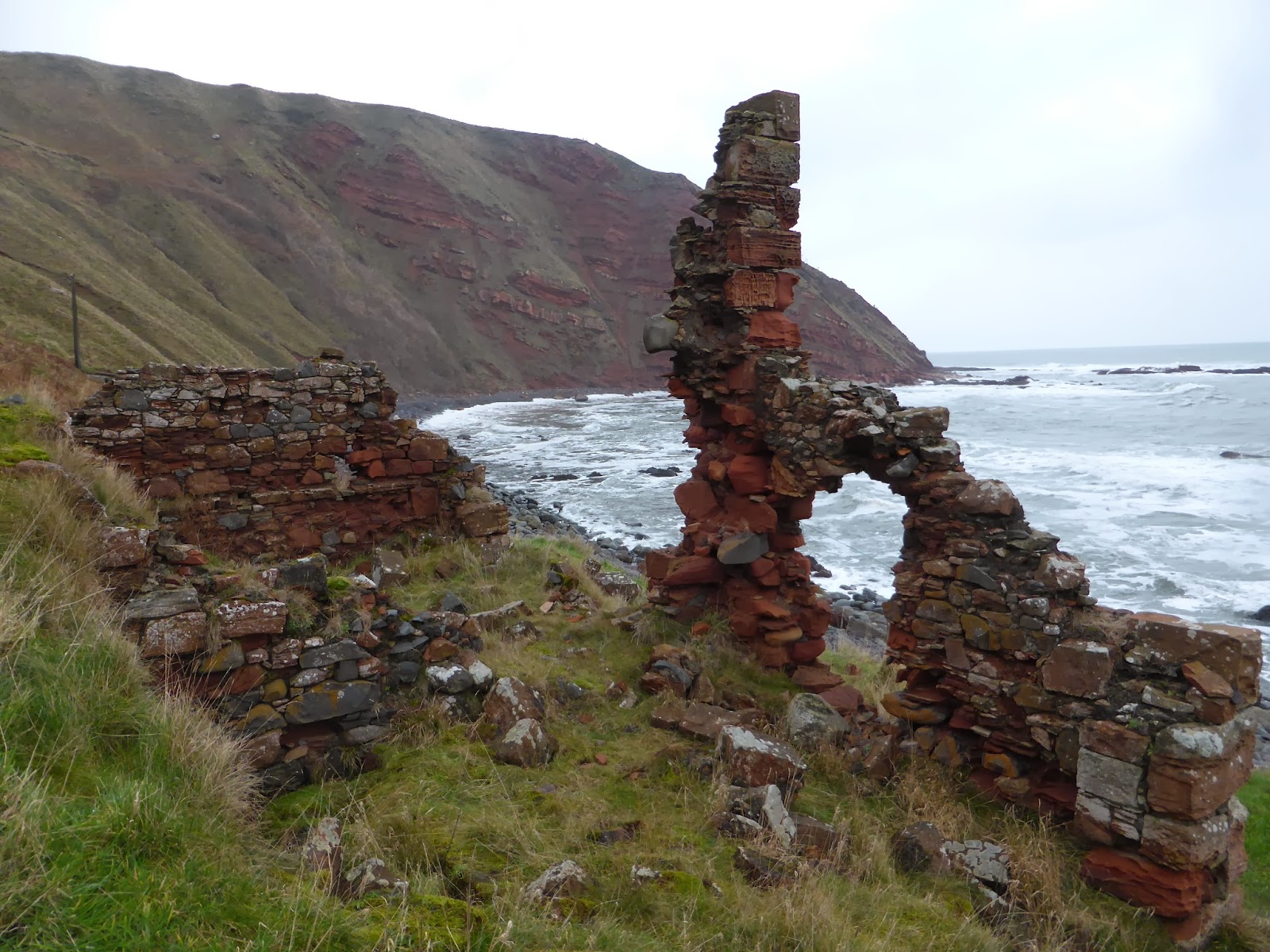
Cockburnspath Tower sits above a deep rocky ravine with the tower burn running beneath it. The castle has been on record since the 11th century & due to it's strategic position it was at the forefront of many border dispute battles between Scotland & England.

Within the Tower's outer buildings is this brick & corrugated iron shed, I'm not sure exactly it's purpose but think that it could be an air raid shelter or some sort of farm shed or store ?


Pease bridge was built in 1786 by David Henderson mason/architect. Comprising of four tall arches, it is 300ft long X 16ft wide X 130ft high, the parapit is surmounted by iron railings. The bridge which spans the Pease Dean was the highest in the world at the time of construction.


Just after passing Redheugh farm then down a very wet & muddy farm track I arrive at the old coastguard cottages where I did have a little snoop about & they appear to be still in use as holiday cottages. And around the back of the cottages the old cart path leading down to the shore.


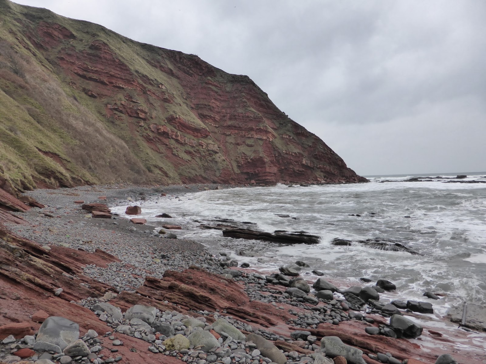
Stopping to take a couple of pictures along the coast.


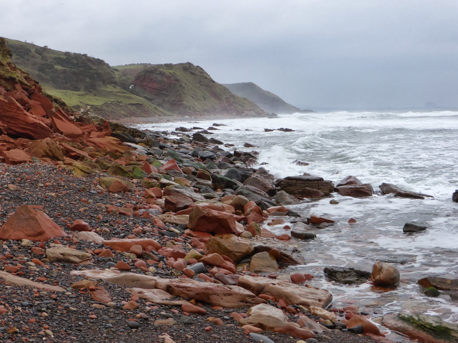


Down on the shore & the ever encroaching tide still coming in I scrambled around the Hirst Rocks eventually making the decision to ditch the bike & continue on foot as the rocks were just too big & awkward to carry the bike.


Utterly amazing geology down here, the photos don't do the redness of the rock justice, there must be millions of years of layers of silt fossilised into rock then through tectonic or volcanic activity they have been lifted up to this angle, if you look closely at the middle picture you can see a layer of fossilised beach.


Scrambling up & over the fallen rock to the pebble strewn beach, the location of the salmon station & bothy's are.


While down here I wondered why these buildings were here & not further up the coast where it would be more accessible, this place is so secluded, lovely though I could live down here no problem just as long as I had no neighbours to annoy me.

It's a real treasure trove down on this secluded shore I found all sorts of interesting stuff from fishing lures, old lobster creels, nets, balls, flipflops so on so on, Bear Grylls could survive for weeks down here, but it was a different type of treasure that I was looking for...

...another geocache :-)


Starting to get concerned about how quick the tide was coming in I thought I'd better high tail it back around the corner to where my bike was & what a buzz it was the high tide for today was 5.4 metres with an easterly, the noise was deafening with the waves rolling the rocks back & forward & the banging as the water impacted with the gouged out cliffs, waiting to judge my timing to get onto the boulders I got totally soaked by the waves crashing around me & I couldn't help but think I'm either going to get washed out to sea here or with all the rain we've had & the ferocity of the waves battering the cliffs I thought there would be a rock fall which would either kill me or trap me like the movie 127 hours amazing what goes through the mind when in danger ! I was never so glad to see my bike & get back onto the beach.


Exploring the beach further westwards before the soggy & muddy hill climb, came across this cool waterfall thundering down the cliff.


For sure going to pack the tent onto the bike during the summer months & spend a night down here a brilliant place to be & there's even a BBQ made from the base of an old lobster creel to cook the sausages for breakfast, perfect.


What a laborious job it must of been building these steps to the top, you need legs like a mountain goat to climb them.
Anyway that was an adventure & I will check the tide tables the next time I come down here !
Thanks for looking & come back soon for another visit.
Cheerio for now.