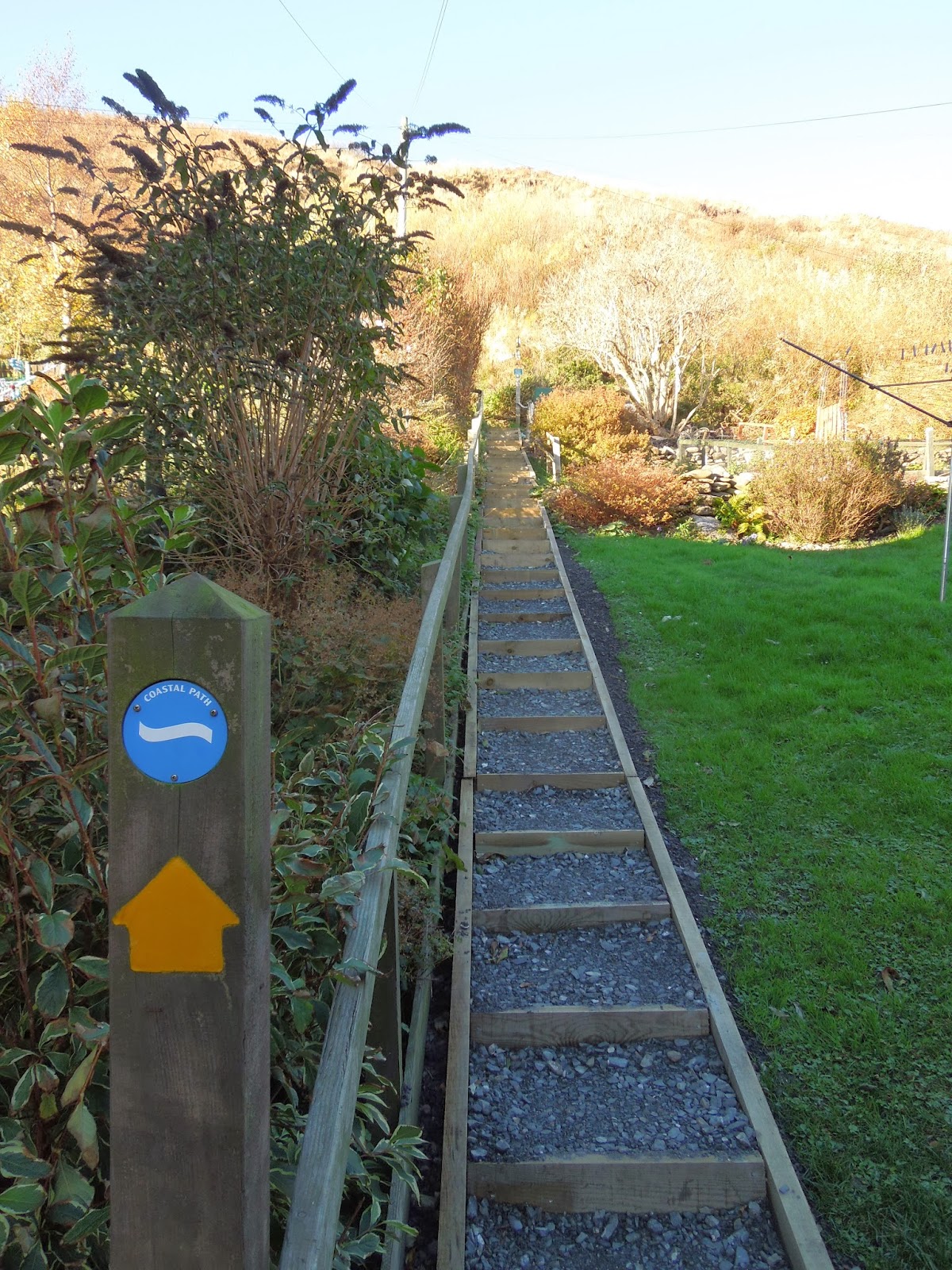
Had a day of work on Monday so I planned to cycle the 'Berwickshire Coastal Path' from the town of Berwick upon Tweed just over the border in England to the end of the route in Cockburnspath Scotland a distance of 29 miles. The route hugs the coastline through farmland & cliff tops climbing over the second highest cliffs on the east coast of the U.K. at a height of 340ft. So a friend from work who lives in Berwick upon Tweed who was working night shift gave me a lift down to Berwick in the morning so I could start the trail & head homeward...


There are 3 bridges crossing the river Tweed in Berwick 2 road bridges & 1 rail bridge, the bottom photo with the bridge in the foreground is the most modern of the 3 & is called the Royal Tweed Bridge which is a road bridge with 2 lanes & was built in 1925-1928, the bridge in the background is the iconic rail bridge called the Royal Border Bridge which carries the railway & is the highest of the 3 bridges built between 1847-1850, finally the top photo shows the Berwick Bridge a single carriageway bridge built between 1611-1624.


Some views along coastline in Berwick.


Berwick is an old fortified walled town steeped in history & has seen it's fair share of battles between Scotland & England as well as other conflicts.


Berwick lighthouse & the coast watch tower run by volunteers who keep visual watch over all coastal areas around the bays & beaches of Berwick in support of search & rescue operations, they also keep a listening watch on the VHF marine distress channel 16.


Along the cliff tops heading towards the Scottish border some pictures of strange geology & the effect of coastal erosion through the ages eating away at the soft sandstone cliffs creating little coves.


The route takes you through this nice small caravan park with cracking views looking out to sea, but stopping to look back at the park once I had passed through it, I couldn't help but think that they look at bit precarious sitting on the edge of the cliffs especially when you can see that a giant chunk of cliff has slipped away from the face !


Crossing the border into Scotland even the east coast main rail line has a nice border marker.


With the sun slowly rising behind me this highlighted the autumn colours. An old derelict house down the cliffs towards the shore, I couldn't believe the amount of fish boxes washed up along the shore here there must have been dozens of them, they must be worth a few quid, not that easy to retrieve though.


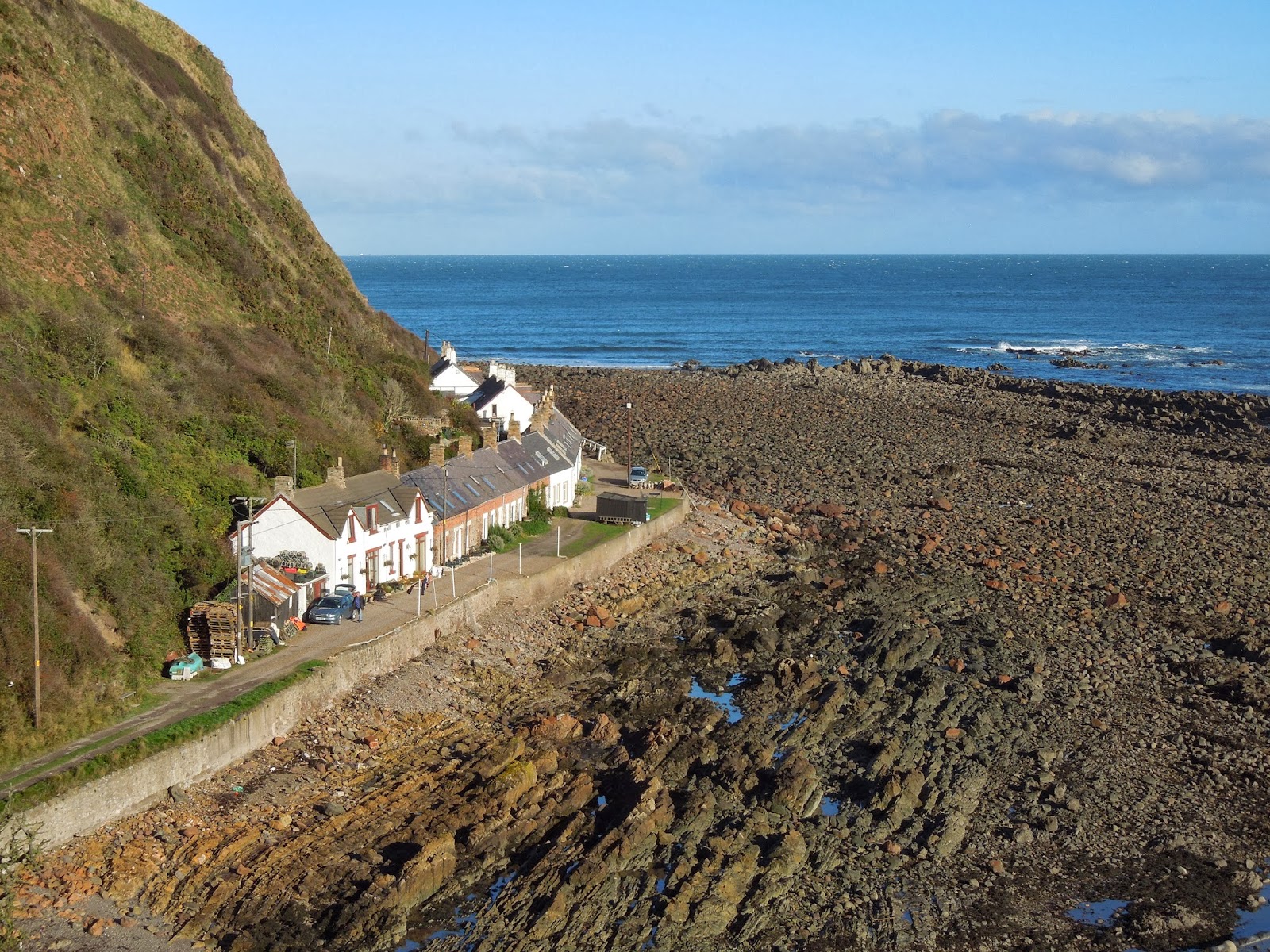


Heading down into & up out of Burnmouth a lovely little fishing community which has a very Cornish feel to it, it's a strange little place as although it is one village it is split up into Upper Burnmouth & Lower Burnmouth which is further divided into 3 smaller communities of Partanhall, Cowdrait & Ross.
It's not a place I would like to live when there are big storms as the houses are very low lying & very close to the tidal zone.


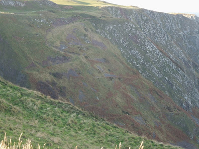
Some amazing dramatic cliffs & with the slow rising sun it highlights the shadows where all the buckling & folding of the rocks during volcanic & tectonic activity millions of years ago.


Along the trail nearing the fishing town of Eyemouth, some frosty parts along the path where the sun hasn't yet reached & where it has thawed making it quite muddy, but now that the Kona is wearing some new Schwalbe Nobby Nic tyres it's not a problem.


The busy Eyemouth harbour, the trawlers seem massive compared to the little prawn & lobster boats back home at Dunbar harbour.


Gunsgreen House built by local smuggler & merchant John Nisbet in the 1750's, now a museum to the past smuggling trade with vaulted cellars & tea chute. And below in the harbour an unusual thing to see here in Scotland is a Chinese Junk !
Some information panels leaving Eyemouth.


One of 12 bronze trail markers commemorating the east coast fishing disaster of 1881 when a storm resulted in the loss of 189 lives amongst the fishing fleets along the coast.


 Scenery shots heading towards Coldingham bay.


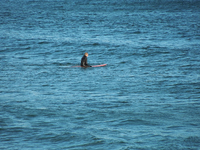


 Rounding the headland of Milldown Point & entering into Coldingham Bay, a real busy hot spot for beach lovers through the summer months but on a cold fresh day like this the only people here are a surfer dude & a mountain biker cycling along the coast !


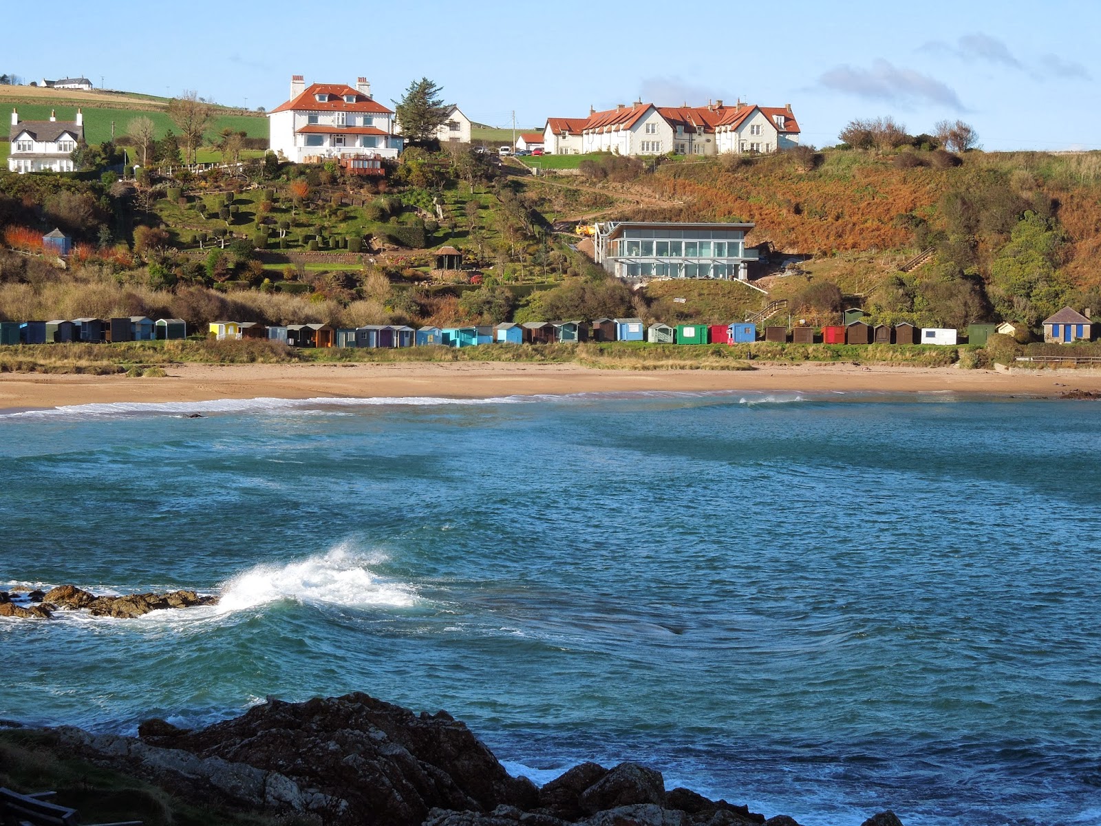
 The stunning little seaside village of St.Abbs a beautiful place to spend some time, it has so much to offer for a little village with the cliff top walks, bird watching, charter fishing trips & not forgetting diving trips St.Abbs is a real mecca for divers.


 Just outside the village is St.Abbs Head which is a national nature reserve for a variety of species from bird life to plants & insects.


 An amazing bit of the coast here absolutely stunning.


 Up high standing guard is the St.Abbs lighthouse built in 1862 by the brothers David & Thomas Stevenson. The light initially used oil to generate it's light, it was converted to incandescent power in 1906 & to electricity in 1966 & finally automated in 1993. Before automation the lighthouse was staffed by 3 full time keepers whose duties included keeping detailed weather records.
A foghorn was established at the Head in 1876 being the first audible fog signal in Scotland. The original foghorn was driven by hot air engines before being replaced by oil driven ones in 1911 & then by diesel engines in 1955. The fog signal was discontinued in 1987.


 Leaving behind the lighthouse after sitting for a while for something to eat & admiring the views & around the corner were the familiar sights far in the distance of the Bass Rock, Torness power station & LaFarge cement works.

 More big climbs ahead.

 Mire loch which lies just behind the hills of St.Abbs Head.


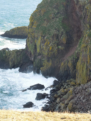
 The rugged coastline with the sea relentlessly battering the base of the cliffs.
 An admiralty distance pole for measuring the measured mile, I could see another further along the coast which I take it would be a mile, unfortunately I forgot to take a picture of that one.


 More cliff views, at some points you are precariously close to the edge of a steep drop,

 (Top)-Coldingham Loch trout fishery where I have spent many a day fishing for trout.
(Bottom)- Where the water from the burn falls into the sea, I walked over to the edge to have a look at the waterfall & got the fright of my life as I was standing on a clump of grass at the edge of a huge cliff that just plummeted straight down vertical !


 A very up & down section of the route & with the sun starting to go down it was time to get a shifty on as I had no lights with me.
 Pausing for a breather after another rollercoaster hill to climb I spotted this old zig-zag road on the side of this hill leading down to a beach below, the track is clearly now unused & I'm guessing it was an old road used for hauling fish up from the shore.


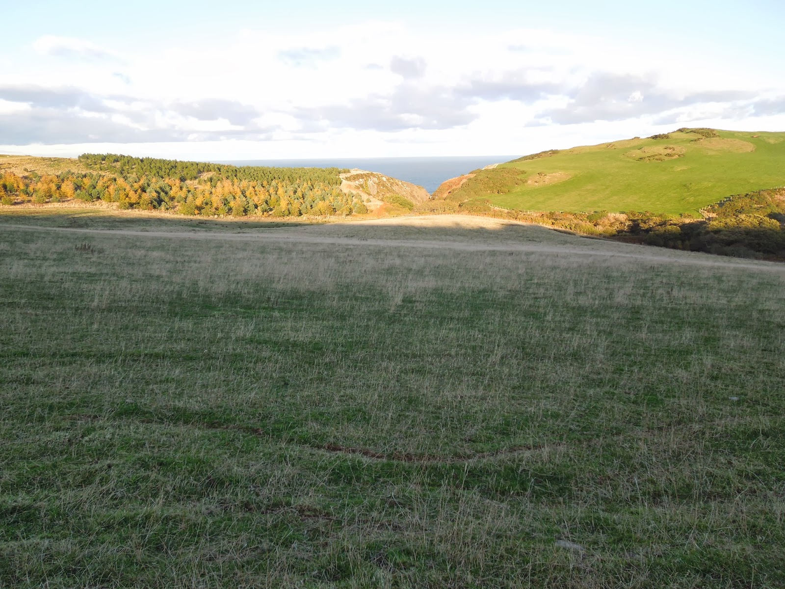
 The route leaves the coast for a small section passing the farm of Dowlaw.


 After Dowlaw & back onto the coast now & pretty much downhill from here to Cockburnspath.


 Passing by Pease Bay & eventually at the finish point at Cockburnspath woohoo job done !
I was expecting this to take 5-6 hours to complete but I totally never gave this route the credit that it deserved, at the start at Berwick I had to deal with hard frost which was good but once it started to thaw the trail just turned to sluggish mud, I had the cold wind on my face the whole way as I was heading west & many sections the trail seemed to be just sheep trails which were thick clumps of grass & were almost impossible to cycle on, then towards St.Abbs the clifftop trail was a real rollercoaster with great downhill sections but when you go down a hill you have a hill to go up & the hills were steep & long. In total the route took me 9 hours from Berwick to my house in Innerwick & it was a great route to tick off the 'cycles to do list', the scenery was second to none the sheer scale of the rugged coastal cliffs, the views along the coast & the chocolate box little fishing towns & villages that the route takes you through, all in all it was a great day out & I will do it again one day but I will do it in the opposite direction so the wind is on my tail !
Thanks for looking & I hope you enjoyed
'The Berwickshire Coastal Path'
Bye for now.


A foghorn was established at the Head in 1876 being the first audible fog signal in Scotland. The original foghorn was driven by hot air engines before being replaced by oil driven ones in 1911 & then by diesel engines in 1955. The fog signal was discontinued in 1987.


(Bottom)- Where the water from the burn falls into the sea, I walked over to the edge to have a look at the waterfall & got the fright of my life as I was standing on a clump of grass at the edge of a huge cliff that just plummeted straight down vertical !


I was expecting this to take 5-6 hours to complete but I totally never gave this route the credit that it deserved, at the start at Berwick I had to deal with hard frost which was good but once it started to thaw the trail just turned to sluggish mud, I had the cold wind on my face the whole way as I was heading west & many sections the trail seemed to be just sheep trails which were thick clumps of grass & were almost impossible to cycle on, then towards St.Abbs the clifftop trail was a real rollercoaster with great downhill sections but when you go down a hill you have a hill to go up & the hills were steep & long. In total the route took me 9 hours from Berwick to my house in Innerwick & it was a great route to tick off the 'cycles to do list', the scenery was second to none the sheer scale of the rugged coastal cliffs, the views along the coast & the chocolate box little fishing towns & villages that the route takes you through, all in all it was a great day out & I will do it again one day but I will do it in the opposite direction so the wind is on my tail !
Thanks for looking & I hope you enjoyed
'The Berwickshire Coastal Path'
Bye for now.
No comments:
Post a Comment