Day 3 of the Rob Roy Way & the adventure continues...


Waking up in the wee small hours to see 'will-o'-the-wisp' shining in the trees trying to lure this weary traveller off his safe path but I just rolled over & went back to sleep.
'Will-o'-the-wisp' or 'ignis fatuus' in medieval latin meaning foolish fire, is an atmospheric ghost light seen by travellers at night, especially over bogs, swamps & marshes.
It resembles a flickering lamp & is said to recede if approached, drawing travellers from the safety of their path into bogs & swamps.
It is thought that the phenomenon is the result of the combustion of natural gases in swamps & marshes.


Waking up energised & looking forward to another day on the RRW, I made myself some bacon, egg & black pudding rolls washed down with a lovely big mug of hot coffee. After breakfast I washed myself & breakfast dishes then packed up camp & went on my way, as I emerged from the thick pine forest it turned out to be a beautiful sunny day.


Highland cow & her calf still waking up.


My first port of call for the day took me off the RRW route & along to Balquhidder churchyard to visit Rob Roy MacGregor's grave.
As I was cycling along a little red squirrel jumped out from the bushes & ran along the road in front of me before scurrying up a tree.


After a couple of miles along a small single track road I soon arrived at Balquhidder kirk & the old ruined kirk.
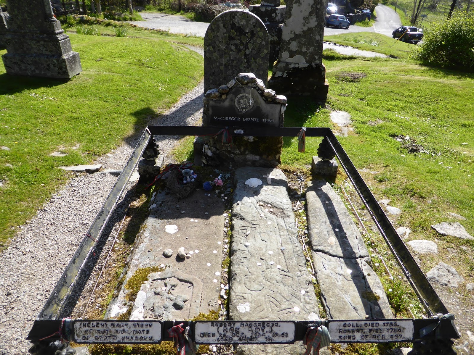


The grave of Rob Roy MacGregor with his widow to his right & two of his sons to his left. The grave had all sorts of stuff on & around it from people visiting the graveside, money, jewellery, flowers, pieces of tartan & other small items.


After visiting the grave I about turned & head back towards the RRW route again, on the way back I noticed what I first thought was a little church that I'd missed when I cycled past the first time After a bit of research it turns out that it's the MacGregor mausoleum at Auchtubh, the ancestral burial place for the Chiefs of the Clan Gregor.
Unfortunately there gates were chained & padlocked so nobody could get in for a look.


By the roadside a local crofter has been kind enough to hang a cup so that thirsty travellers can refresh themselves with a drink of some of Scotlands purest mountain water.
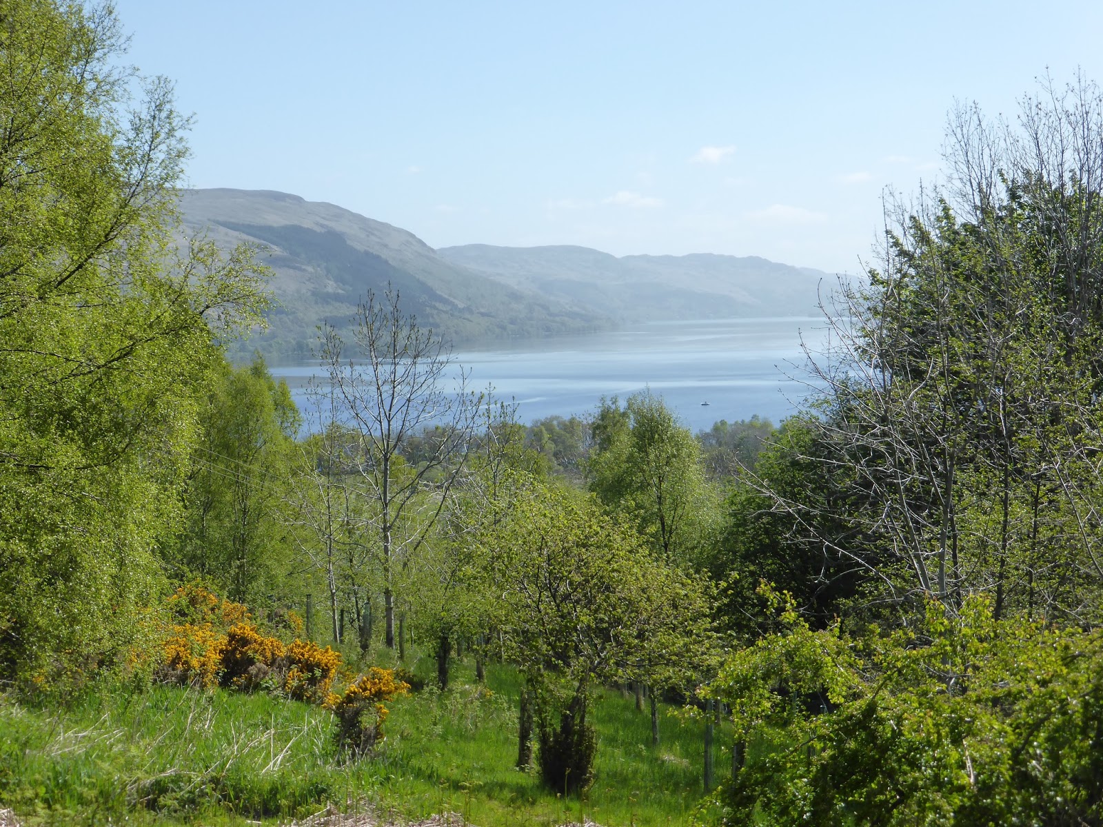
Looking back along the glen towards Strathyre & the pine trees on the hill to the left is where I camped for the night.


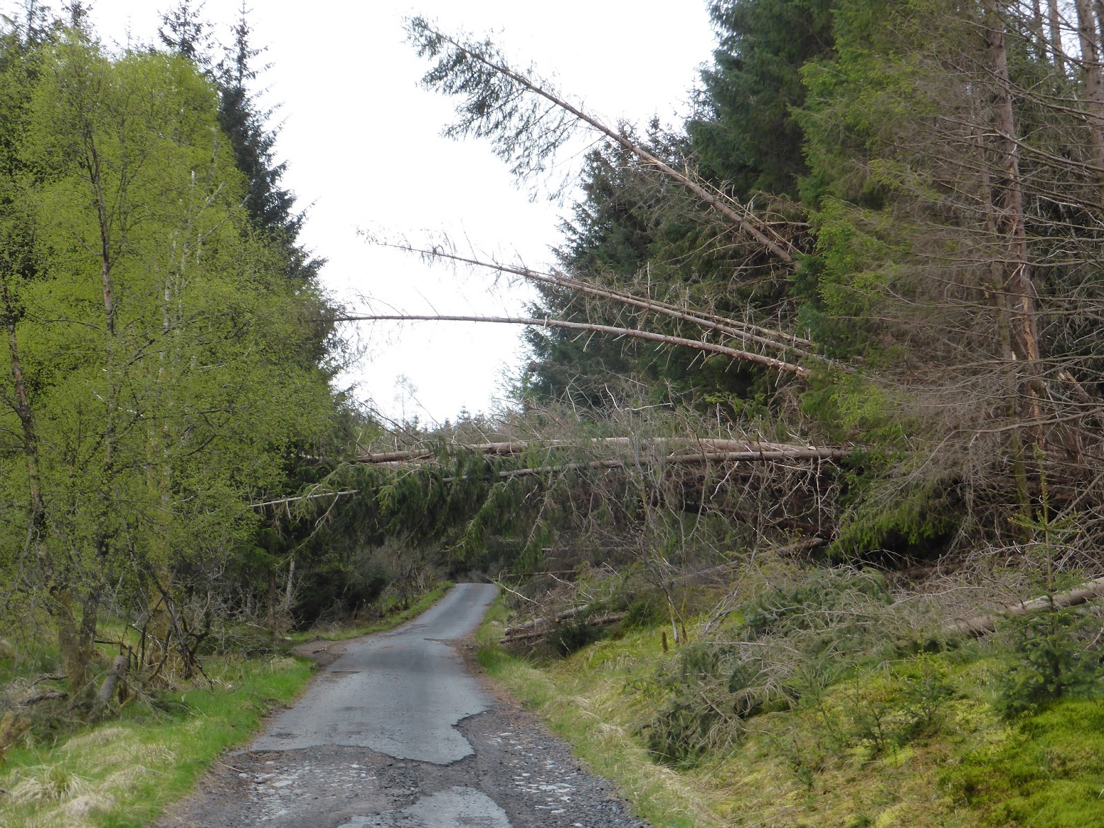
Back on the RRW route again along another old railway track which at parts runs next to the very busy A84 road so it was quite noisy with traffic but still a pleasant cycle.
Along sections of old rail track are these National Cycle Network marker posts & most of them are modelled in a way with something to do with the rail industry.


Crossing this viaduct which had amazing views looking down on the Kendrum Burn & the thick covering of birch trees.


Under the old railway bridge & the route turns sharply left onto a series of very very steep hairpin bends.


The higher I climbed the better the view I was getting when stopping to catch my breath & have a drink.
Looking lengthways along Loch Earn.


Finally the hairpin bends came to an end & the reward was this view of Loch Earn & the small village of Lochearnhead. There were a few boats playing about in the loch & all I could think about was how good it would be to jump in that loch to cool down after climbing that hill.


Back on a dismantled old railway again along Glen Ogle which was quite hard going as the track was slowly climbing all the time.


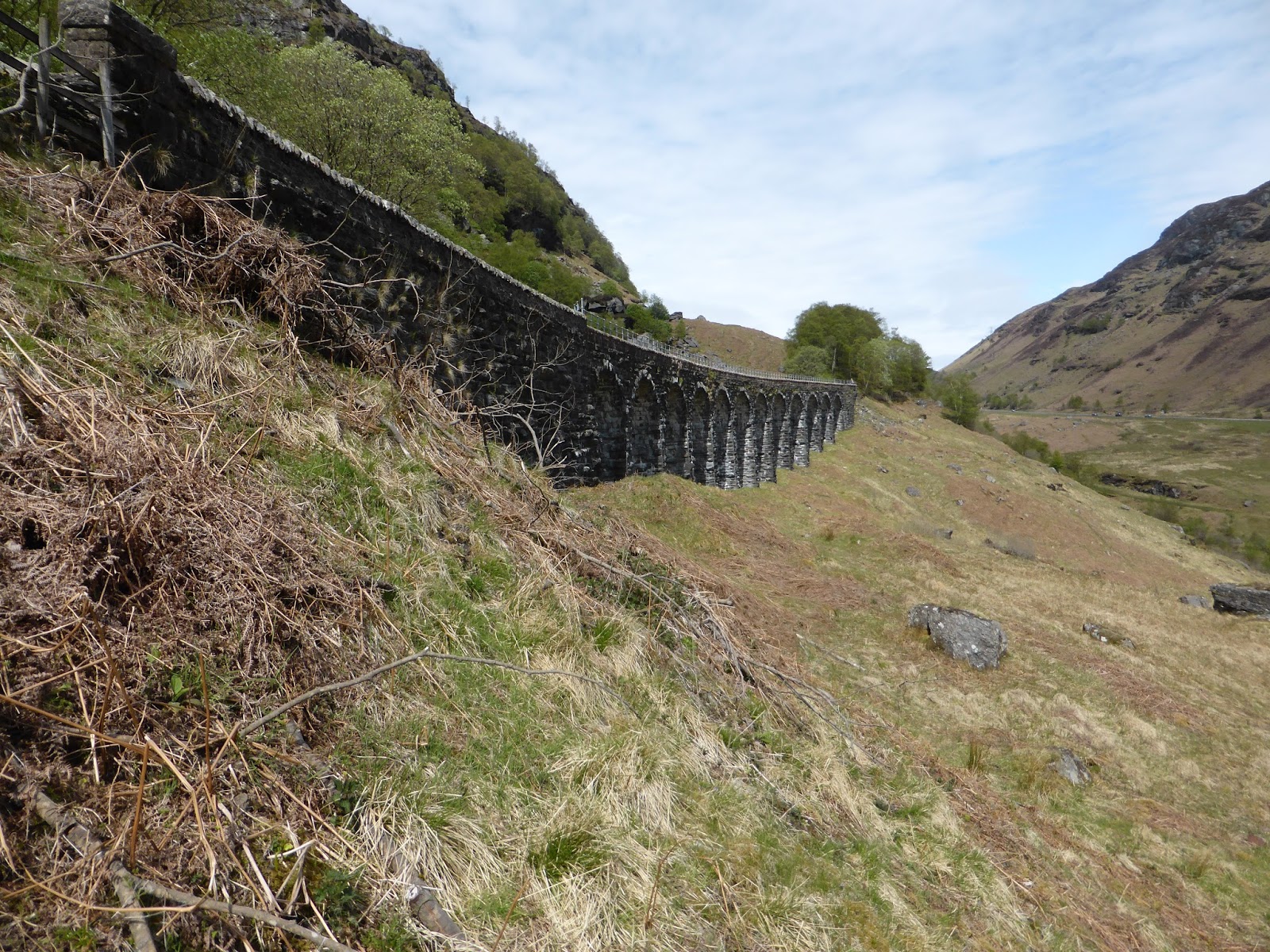


Eventually arriving at the famous Glen Ogle viaduct, probably one of the most photographed places in Scotland.
Seen from the A85 road pictured above it does look very impressive from the roadside.
I could of spent ages here watching & listening to all the motorbikes giving it what for going up & down the road, the echo from the bikes exhausts howling through the glen was amazing & I could feel my throttle hand getting a bit twitchy !


Looking southwards back along the way I came.


This section along Glen Ogle never seemed to end but I was quite happy plodding along like an old steam train.


A fairly dangerous crossing, over the A85 as this is a fast road.

In 1994 an R.A.F. Tornado aircraft was engaged in a low-level training sortie over Scotland, including a pass down Glen Ogle at a height of 150m (500ft).
While flying down Glen Ogle the aircraft bore right to follow the line of the valley, however as the Tornado banked & the pilot applied re-heat to both engines, the aircraft inverted through 180 degrees.
At this point one of the wings made contact with the ground causing the aircraft to crash.


Again coming to another route choice.
To the right avoids going into the village of Killin, but I needed to go into Killin to load up with supplies, water, drinks for the bottles on my bike, milk & breakfast items for the following morning & while I was there I thought I'd buy a bottle of cider for a treat since it was going to be my last night camping.
The track leading down into Killin was amazing through the Acharn Forest it was a fast roller coaster ride down along the well maintained cycle path.


...which ended up back on forestry road & then another dismantled railway track.


The Falls of Dochart crashing over the rocks just before entering into Loch Tay & always worth stopping to watch the mesmerising water gouging through the rock & take some photos.

The Falls of Dochart flow under the Bridge of Dochart & around the islands of Inchbuie known as the traditional & ancient burial ground of Clan Macnab.


Loaded up with supplies I head back up through the village to head out of Killin when I noticed a bit of activity with a large group of tourists pointing cameras over the wall towards the Falls of Dochart. I had to see what the fuss was about only to find this guy playing about the rocks, it looked good so I watched for a while & the devil in me was hoping he was going to fall off but he didn't so I left.


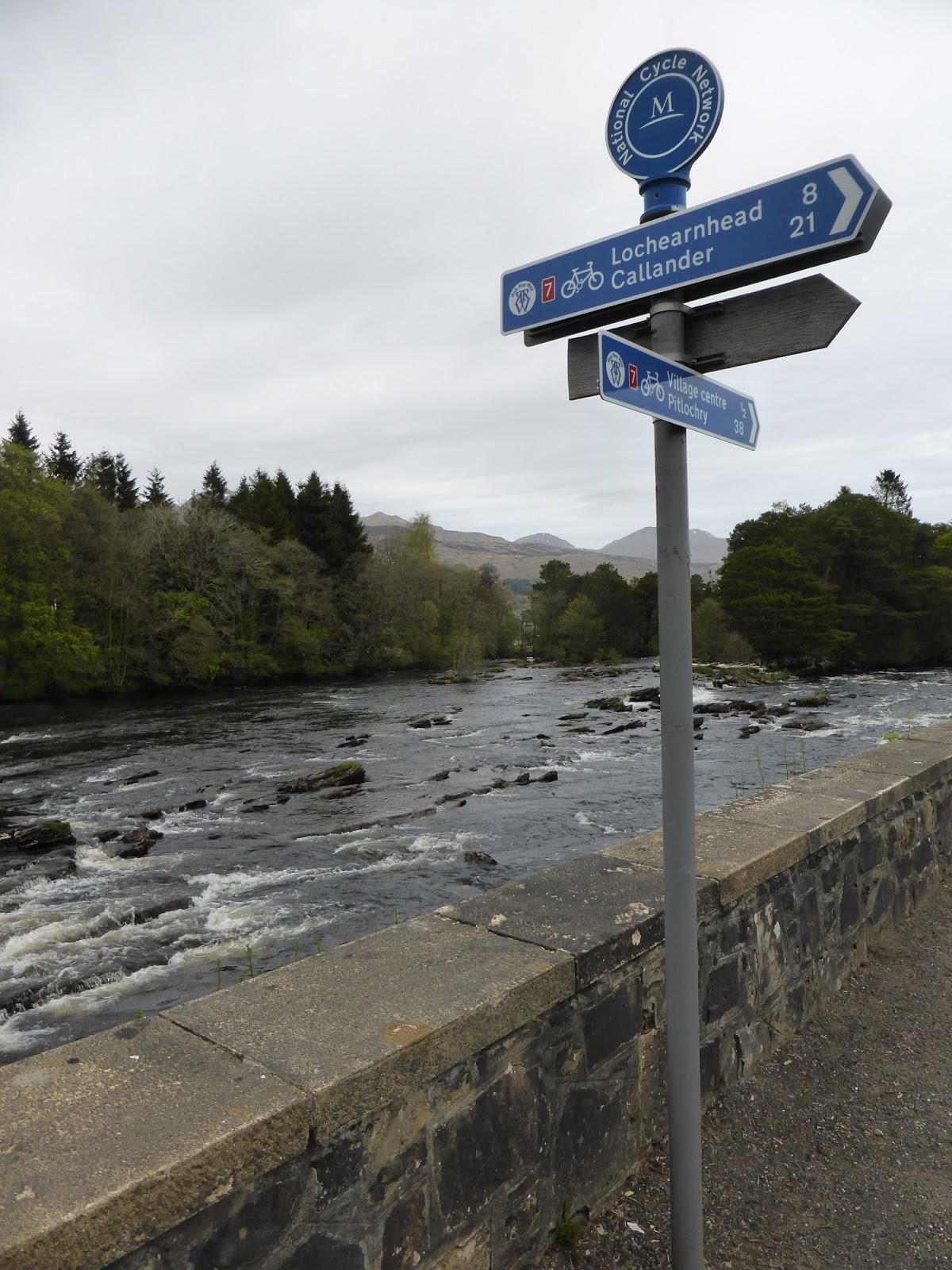
The route out of Killin follows a single track road along the south side of Loch Tay for a short while before turning off again into the woods.


This was a killer of a climb it just never seemed to end, once past the clearings it was into thick pine forest on a single track road at an ever constant steep gradient, it was hot & very hard work but I kept the head down & kept on going as it had to end sooner or later !


At last the pine forest ended but the climb was nowhere near finished, at least now I could see ahead at how far I had to go & how far I had come.


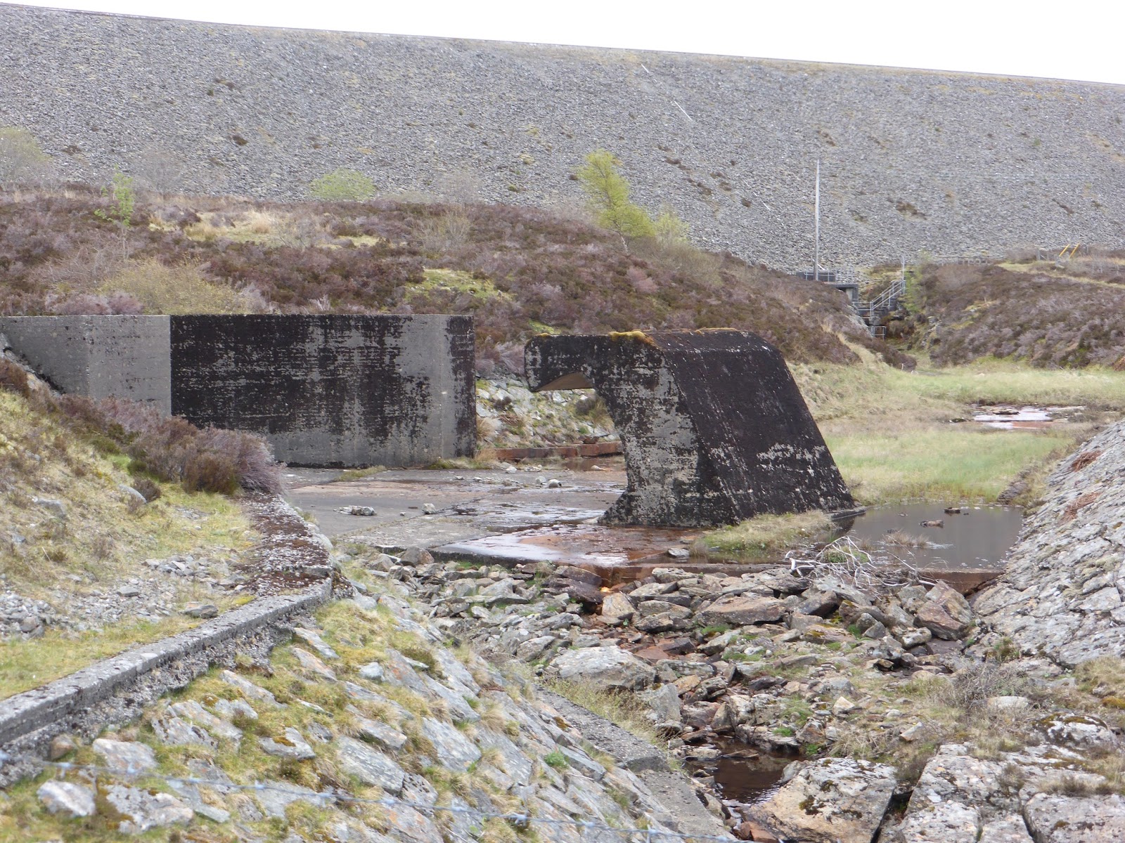
Stopping to re-hydrate & marvel at the Breaclaich Dam. I love dams & reservoirs they are amazingly engineered. See the above picture of the concrete wave painted black which is for when the dam overflows water will cascade down & crash into this wave taking most of the energy out of the water before it is then guided down hill.


The overflow channel with concrete wave at the bottom.


The concrete bathtub which is huge is where the water spills into when the level is at capacity then flowing down the channel & down to the wave all in a controlled manner.


The track still climbs & climbs up past the Breaclaich reservoir & it's draw off tower, but at least I can see the end of the climb & once I'm at the top I know I've got downhill all the way to Loch Tay.


Made it to the top.
So after the hard fought climb up here which was near enough five & a half miles of more or less non stop uphill all the way from Killin, I think I earned a half our break to soak up these amazing views.
This was the highest point of the entire RRW route.


The first sighting of Loch Tay since that horrible climb up from Killin, the views from here were outstanding, other than the road I was on there was nothing man made as far as the eye could see.


From the top it was downhill following a rough stone track which brought me to the water pipeline from the Breaclaich reservoir, I knew when I reached where the pipeline turned that I needed to go off in another direction.


From the pipeline I needed to aim for between the two small plantations of trees keeping close to the trees on the right & Loch Tay in the middle.
It was an absolute nightmare of a descent deep spongy bog which was at places impossible to cycle down with my weight & the weight of all the gear my bike was carrying, the bike was bogged down & well over the rims, so it was off & pushing downhill !
I was gutted especially after the hard work getting to the top !


On the way down the reedy bogs dried up & finally I was onto more ridable terrain.
I passed a small collection of shielings on the way down.
Shielings are buildings that were built in the remotest of places in the Scottish hills & mountains & used as summer residences for farmers so that their livestock could graze up in the high pastures.


Onto a rough track now & I was making haste bombing down the hill when I suddenly remembered that I had eggs & a bottle of cider in the panniers :-/

I'm glad I found & stuck to the right track, there was no warning sign like this at the top of the hill.


After passing Brae farm it was a super fast descent down to Ardeonaig & back onto the single track south road along Loch Tay


I had to stop for five minutes after cooking my brakes bombing down the hill at high speed, but it was a good excuse to meet the local sheep.


Now at Ardeonaig I took the opportunity to have a wash in the Ardeonaig burn as I was covered in peaty mud after the first part downhill past the pipeline, while washing the peaty mud off there was one wee bit of mud that wouldn't move, turned out it was a horrible parasitic tick that must off latched on while pushing down through the reedy bog, luckily it was still in the process of burrowing it's head into my leg, so with a pinch I hauled the horrible thing out of my leg & squashed it between my fingers then washed it off in the burn.
Eugh I hate those things !


The cycle along the loch side was really nice, beautiful views along Loch Tay & the majestic mountain Ben Lawers.


A nice wee project for someone to turn it into a holiday cottage.


Over the border into the district of Perth & Kinross & now I'm looking for my planned location for my final camp site of the trip.


One final big climb uphill to my wild camp spot for the night, it was a real struggle to get up here but once up first job was get the tent up as there was a change in the air & it felt like rain was on the way.


With the smell of rain in the air I wanted to get dinner out the way before exploring the reason I wanted to camp here ?
Tonight's menu consisted of chicken yellow curry & rice which was delicious followed by toffee pudding with toffee sauce equally delicious.

Tomnadashan copper mine...

...or as in the Monty Python film the 'Cave of Caerbannog'

A YouTube clip of the killer rabbit scene at the cave of Caerbannog.

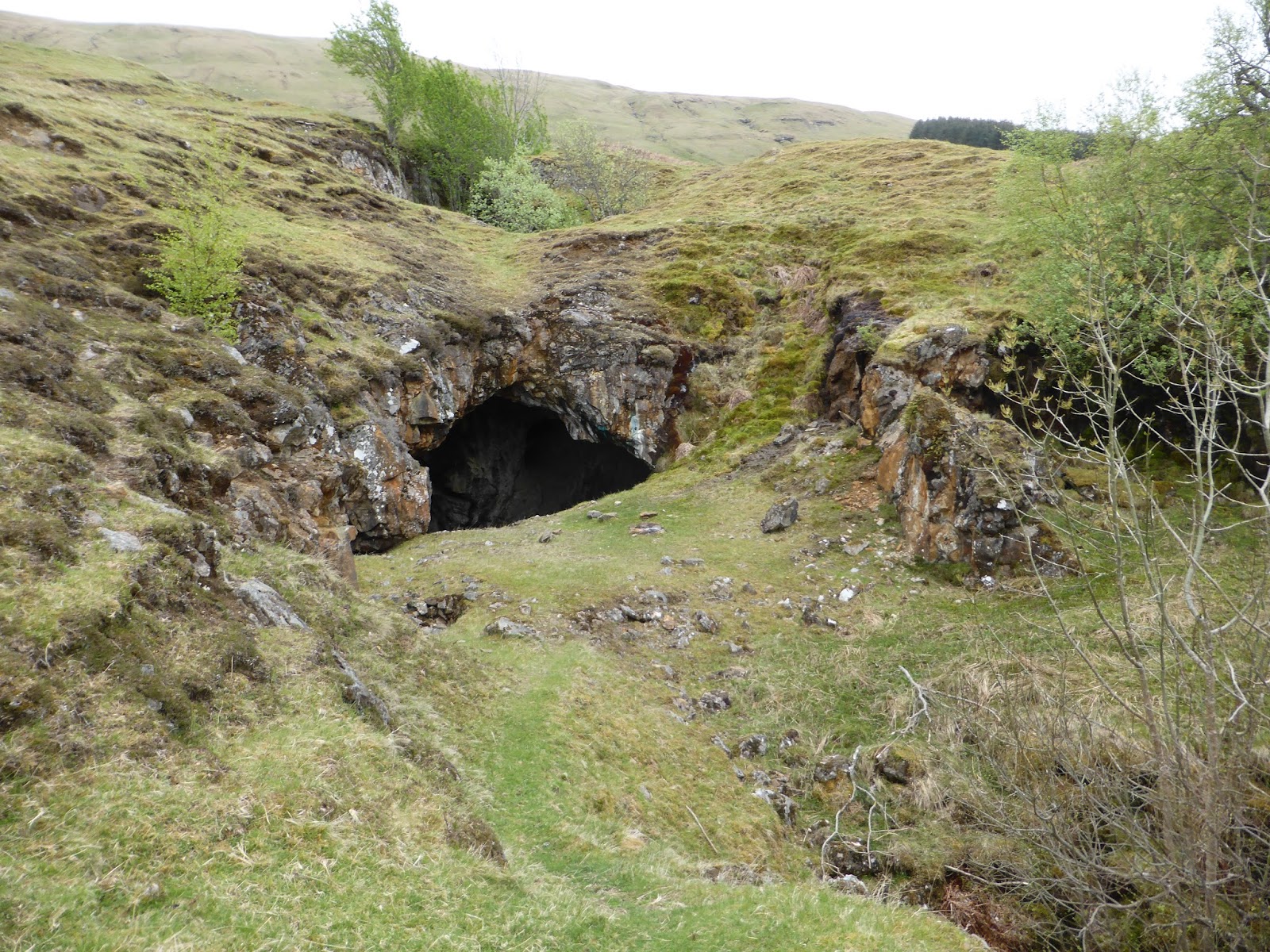


Exploring the cave there were a couple of killer rabbits still lurking around.


How I found out about this location was down to geocaching. When I was planning this trip I searched all the geocaches along the RRW route & this was one that I really wanted to find.
Finding the geocache & signing the log book, there were a couple of movie props hidden with the cache box, the 'Holy Hand Grenade of Antioch' & the coconut halves are to simulate the sound of horses as seen in the movie clip.

Still evidence of the cave's copper mining past.


Some photos of around the outside of the mine.


By now the wind was really picking up quite strongly & I knew the rain wasn't far away, so it was time to bunk up in the tent...


...& enjoy my bottle of cider on my last night's wild camp :-)
Well that's day 3 done only 1 more day to go of this amazing journey, the last & final post of the RRW will be up in a day or two, titled...
...Rob Roy Way - Day 4 of 4 'Ardeonaig to Pitlochry'
Thanks for reading & I hope your enjoying the trip.
No comments:
Post a Comment