A little road trip planned to do something a little bit different from the usual & with an early alarm set for 04:30 I loaded up the van the night before.
Dragging myself out of bed at this obscene hour, a quick wash, a flask of tea brewed & I was out the house on my way by 5am so that I could miss the rush hour weekday traffic.
My wee road trip heading was to the north side of loch Tay to climb two of Scotland's easier but none the less impressive *munros.
My wee road trip heading was to the north side of loch Tay to climb two of Scotland's easier but none the less impressive *munros.
Beinn Ghlas first of all, ranking at number 47 out of a total of 282 on the Scottish munro list, standing at a lofty height of 1103m (3618ft), then onto the 10th highest munro Ben Lawers reaching 1214m (3982ft) & once I'm up there the whole plan of the trip a good downhill blast back to the van hopefully with no broken bones.
*(A munro is a Scottish mountain which is over 3000ft)

Missing all the motorway traffic then onto quieter roads passing through the beautiful village of Killin, soon to be following the road along the north side of loch Tay before turning off onto a minor road which takes me up to the Ben Lawers visitor centre & car park where my climb would begin only to find that the visitor centre has gone !

"The visitor centre prior to it's demolition in 2010"
The centre was built in 1972 to raise awareness of protected rare plants such as artic-alpine species which grew in the vicinity. The centres design was not everyone's cup of tea & was branded hideous & in hill walking circles was even called the 'starship enterprise' due to it's unusual looks.
Detractors contended that the buildings mere presence endangered this pristine landscape as hordes of tourists tramped their way through to make use of it's toilets & cafeteria.
I personally don't think it was that ugly :-/


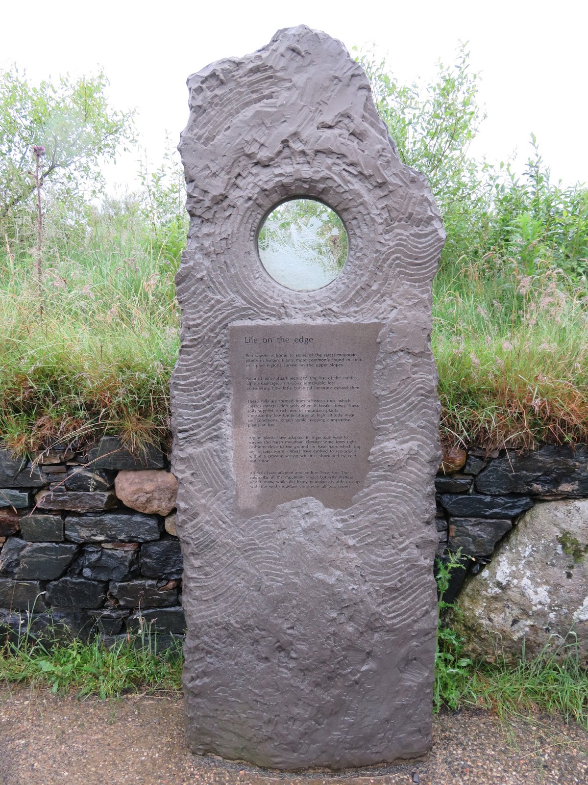

Replacing the visitor centre are these interesting stone tablets continuing to inform people of the history & ecology of the area.


With the rain pouring & the mountains hidden by low cloud I got the camping stove out & made some delicious bacon, egg & sausage rolls for breakfast washed down with a mug of tea & there's not a better smell than the smell of bacon frying out in the wilds shared with the smells of the great outdoors.
Eventually after breakfast the rain had stopped but the thick cloud remained hiding Beinn Ghlas & the surrounding mountains from view. It was a long way to come not to attempt to climb it & with no back up plan I was hoping that the weather forecast was going to be correct, the cloud was due to clear around 11am, so putting my gear on & giving my bike the once over I head off for the mountains.


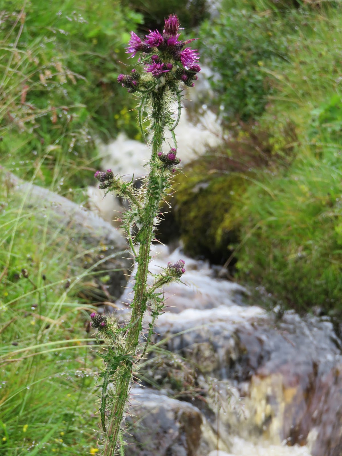
Following the track way & crossing the burn of Edramucky.


The track was a good hard packed rocky pathway with the odd big boulder & stone rain gutter to negotiate, but good progress was being made & I was thinking it's got to get harder soon...
...It did !


Stopping from time to time to soak up the amazing scenery behind me it was quite hypnotic watching the low level clouds drifting through between the mountains.


Soon I was starting to get into the thick of the cloud & from here the terrain became a lot harder, steeper & slippy wet rocks so at some points it was a case of bike over the shoulders & take one step at a time.


The views behind me were coming & going as the cloud swept through eliminating good photo opportunities, which was quite disappointing as the views were getting more & more dramatic the higher I climbed.


Made it :-)
The summit of Beinn Ghlas 'bagged' & look at those amazing views !
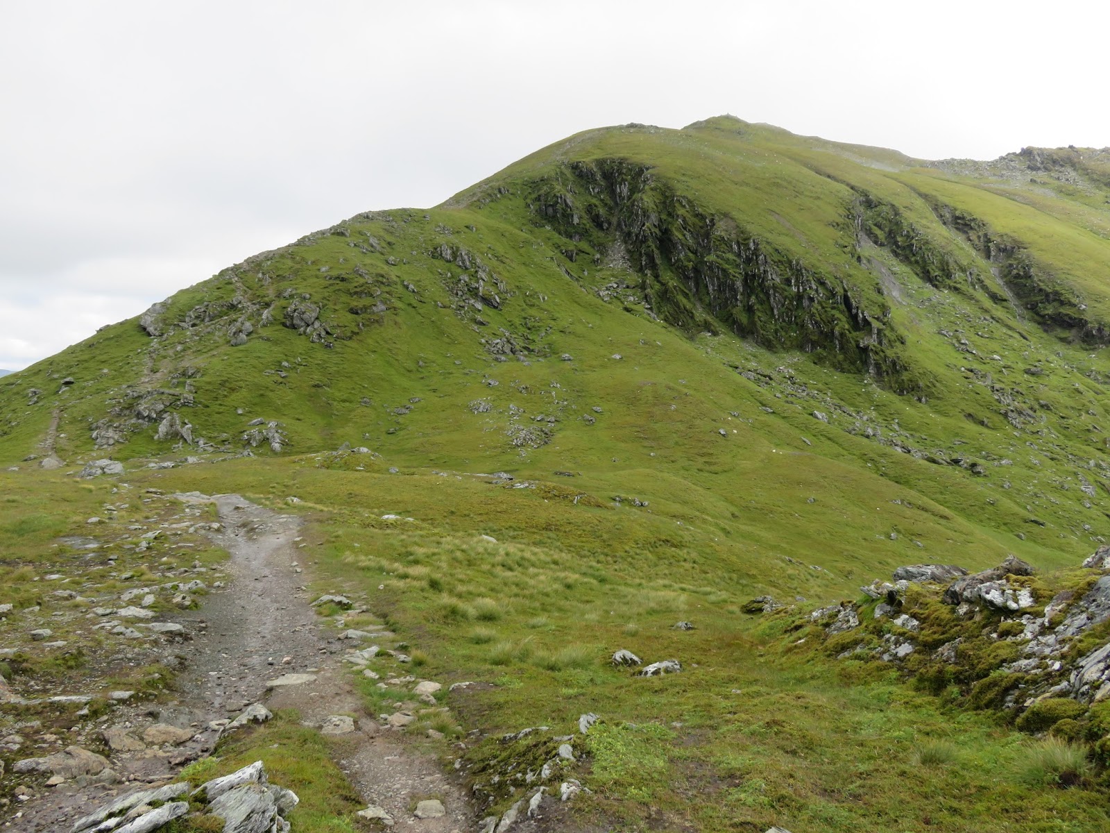
Oh well onwards & upwards to Ben Lawers.

Up & up I went up over the rocky slippy & wet pathway clambering over rocks & boulders & the cloud was really thick now, I could barely make out the track in front of me sometimes so caution was required as I sure footed each step as I went higher & higher.
For a few seconds the cloud thinned out & I could just make out the trig point & the cairn on the summit of Ben Lawers.


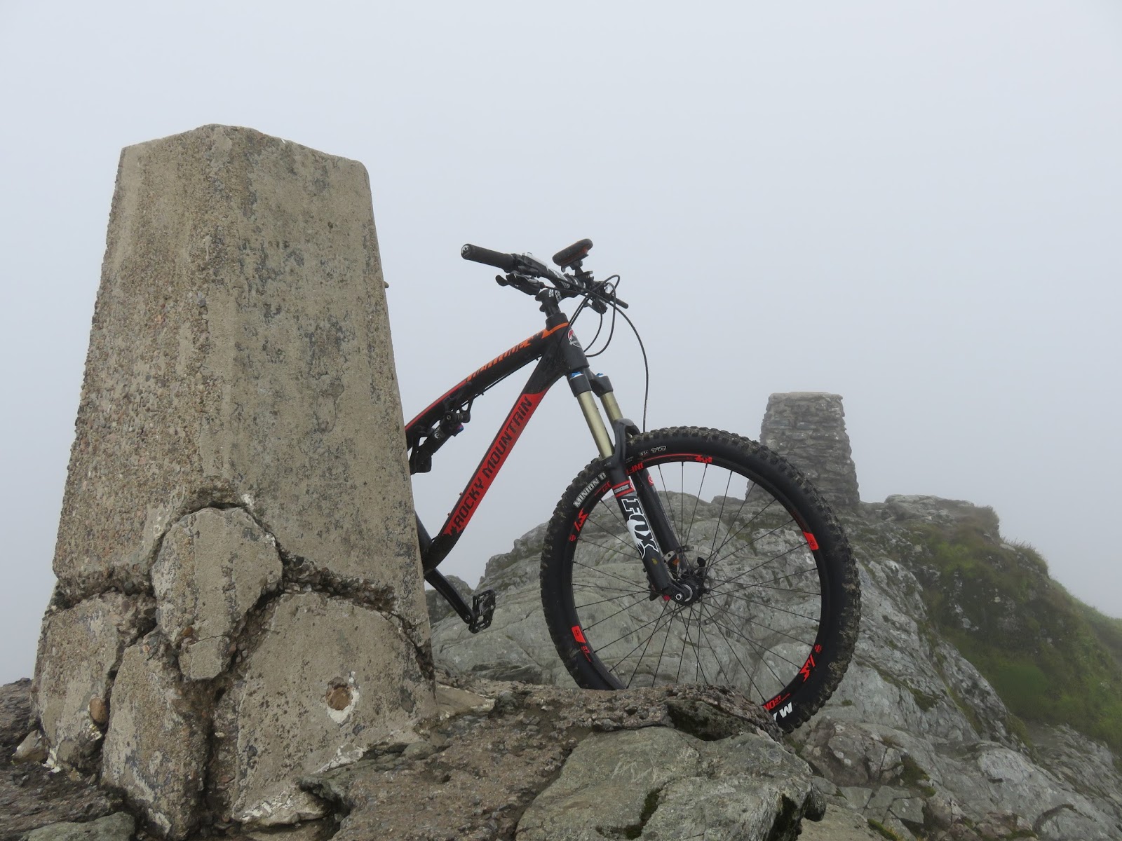


Woohoo made it, Ben Lawers & the trig point 'bagged' & again look at those amazing views, well worth the climb !!!
While I was up here I thought that I'd give it an hour or so to see if the weather forecast was going to be correct with the cloud clearing, so I sat for a while filling my belly putting some fuel back into my engine then went off to search for a geocache that's hidden up here.


Quickly finding the geocache I signed the log book & placed a geocoin that I picked up a while ago into the cache for someone else to find & move on.

The trig point flush bracket on the third highest trig point in the U.K.


My patience was rewarded after about half an hour or so when the cloud started to thin out & for the first time I could start to see some awesome scenery beneath me.


Looking back over the *bealach down to the summit of Beinn Ghlas & with these views opening up I felt kind of robbed to of missed out on them on the way up.
(*bealach = pass)

Lochan na Lairige & dam down below on the north side.


Loch Tay below, a narrow loch of 14.55 miles long & around 1-1.5 miles wide. It's the sixth largest loch in Scotland by area & over 150m-(490ft) deep at it's deepest.


No sooner had the cloud cleared it started rolling in again & with it gone were the photo opportunities of distance shots, disappointed I set off for the fun part & the reason for this trip to ride a mountain bike down a mountain on a Rocky Mountain.

Lochan nan Cat.


The first part of the descent was awesome & the pictures don't do it justice as to how steep it was.


Awe inspiring amazing scenery looking over this deserted landscape just as nature intended.
Looking back up at Ben Lawers & as you can see it's fairly steep.


In the middle of the two munros on the bealach.


Magical rocky mountain views of different sorts.

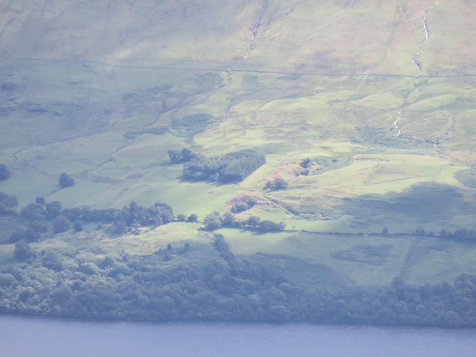

Stopping for a breather & to allow some walkers to pass me by on their way up, I remembered looking over here to Ben Lawers when I camped on the south side of loch Tay when I cycled the Rob Roy Way in May earlier this year. On my third & final wild camp of the trip at the old disused copper mine where the killer rabbit scene was filmed in 'Monty python & the holy grail' movie.
It looked very small from up here but at the time it was a hard steep climb with the bike fully loaded with all the camping gear to get up to the caves.
If you look at the middle picture above, where there is a clump of trees in the centre, that's where I camped & if you read that blog post & you can cast your mind back to the photos that I took from that location, you will remember that it was a good height up looking along loch Tay, but when you see the above pictures it gives you a good scale as to how big these hills & mountains really are.


And more rocky mountain views, the bike really looks at home up here.


A final look back to Ben Lawers before I go over the edge & it will be out of sight.


Looking at the top picture you can just make out the village of Killin at the western head of loch Tay, I could trace the route that I took during my Rob Roy Way adventure up through the what seemed at the time to be a never ending climb up through the pine forest eventually emerging from the forest to the middle picture of Lochan Breaclaich then finally the bottom picture following the the valley behind the ridge downhill to Ardeonaig.


Looking down & looking up to Beinn Ghlas with Ben Lawers hidden higher behind to what turned out to be a brilliant but hard day.

Back to the van with no broken bones, bruises or skint knees & a grin from ear to ear setting me up for the drive back home.
And now after speaking with a work mate who has well & truly planted a seed in my head when he asked me if Iv'e now caught the bug for bagging munros ?
Not a bad idea I think, to see how many I can bag by bike !
Now there's a thought :-/
Anyway I hoped you enjoyed the highs & lows of this ride out
in the clouds.
Thanks for reading & cheers for now.
No comments:
Post a Comment