The Herring Road is a centuries old route which stretches 29 miles & runs south from Dunbar over the Lammermuir Hills to the border town of Lauder.
The herring road is thought to have been predominantly in use during the 18th & 19th centuries when the herring industry was strong, although records of the inland trade in fish go back to the mid 17th century when as many as 20,000 people on occasion were gathered in Dunbar for the herring fishery. 'V' shaped gouges are still visible in parts of the route made by teams of heavily laden pack horses constantly using the same path.
The fishwives were a hardy breed of women carrying creels of salted herring on their backs weighing up to a hundredweight (50 kg's) from the harbours edge up & over the exposed Lammermuir hills to the border town of Lauder to sell at the market.
For me, I am doing the route in reverse from Lauder back the way to Dunbar as it was easier to get my daughter to give me a lift to Lauder then cycle home. I planned a wild camp on this trip just to make a night of it, although it can be done no problem in a day as I done it along with a friend from work last year. The route follows the route of the Southern Upland Way before veering off in another direction where the waymark posts disappear but there is some metal signposts pointing you in the right direction...
...So I would advise you to make a cup of tea or coffee before you read any further as this is a long one ! :-/


So after loading my bike up like a pack horse I made off in the blistering heat, the mercury was reading 26 degrees, very hot for these parts !
Through the farmland crossing over the Leader water where I had my first of many encounter with cows, but they behaved themselves & just stared over at me while chewing. The impressive Thirlestane castle nestled in amongst the trees.
Already glad to be under the cover of trees through the Thicket woods, the heat was so intense made all the worse by the weight I was carrying on the bike.
Out into the open again increasing in altitude all the time, sweat stinging my eyes & tiny harvest flies making me itch all over, I was starting to think if this was such a good idea in this heat but when I stopped for a drink & had a look around at the scenery around me yes it was worth it.
Into another cow field & giving them a wide berth but I think even for them it was too hot to chase.
A really nice overgrown pond at the bottom of this hill with an abundance of birds & insects feeding on the wild flowers, it would of been nice to sit in the stone seat within the wall & take a break but I needed to push on.
Some of the terrain I was finding quite tricky as the grass was long in some fields & was choking up the rear mech.
These Oyster Catchers were very alarmed at my presence I think they may have a nest of young nearby. The bridge spanning the Snawdon burn was built by the Queens University Officers Training Corps.
Fields of long grass, fences, stone walls & the hot sun to negotiate with, this was turning out to be quite a tough day, but I knew at the other side of the Scoured Rig woods that I would be onto hard packed roads & easier cycling.
This is more like it & making good progress & felt now that I was putting in some distance.
Far away in the distance & a zoomed in photo of my camp site for the night.
If I were those sheep I would of been heading into that shed.
Along the length of the Southern Upland Way fixed to waymarker posts are these little metal badges with the word 'ULTREIA' an old pilgrim word implying encouragement to keep going, but their main reason is that it is a clue that somewhere near by there is a kist with treasure to look out for.
As you can see in the pictures the afore mentioned 'V' gouges made by the pack horse carts.
I came across this stone along the route, I'm not exactly sure of it's purpose if it is a boundary stone, distance marker or what I don't know but it's not naturally meant to be there !
Woohoo I found the kist, I can't remember seeing this last year but I did see the waymark post with Ultreia on it but was unaware of it's meaning.
There are 13 kists along the 212 mile route of the SUW & each containing minted coins called '13ths' as there are 13 kists, each kist contains coins that have different pictures on them designed by young artists of history, nature, architecture & technology. There were also SUW pin badges within this kist too.
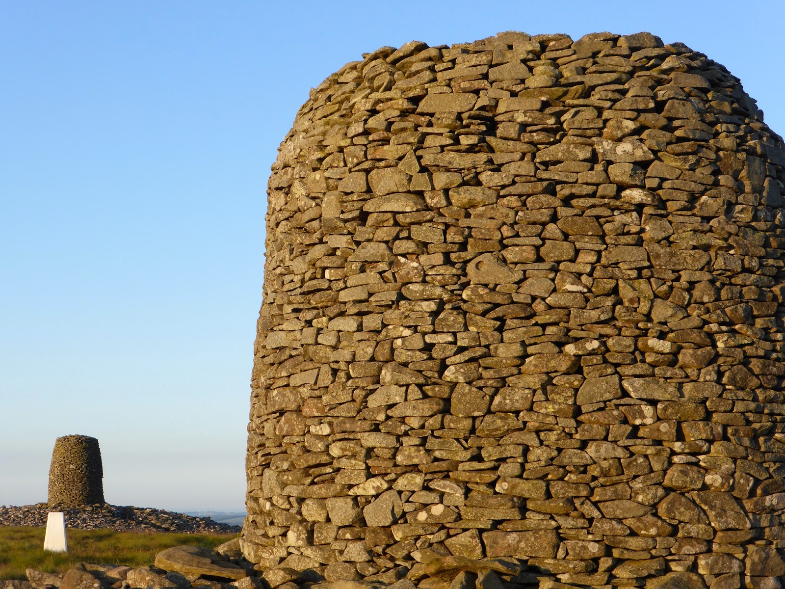
Job done, made it to my camp site for the night at Twin Law Hill with it's impressive Twin Law Cairns.
The story behind the cairns tells of the death of two brothers, traditionally buried here. Separated at birth, the two brothers fought for opposing Scots & Saxon armies. They fought each other hard, not knowing that they were brothers & were both killed in combat. Once the armies learnt of the connection they joined together in building two cairns in their memory.
Before I got the tent up I wanted to find a geocahe that is hidden at this location, after finding the cache & signing the log book I dropped of a trackable geocoin that I picked up from another cache elsewhere, this geocoin's mission was to visit as many trig points as possible, so I thought this was a worthy place to leave it on it's travels & taking some picture to put onto the geocaching website for the geocoins owners to see.
Tent pitched, water on to boil for my meal of boil in the bag beef stew & dumplings & for dessert spotted dick with custard mmm delicious.
While my meal was cooking it was a good opportunity to have a look around my home for the night & grab some pictures of the views around, the Cheviot, Pentland, Lammermuir & Eildon Hills & not forgetting a great view looking down over the Watch reservoir which is another of my favourite trout fisheries.
The cairns were forever changing in appearance as the sun was lowering in the sky highlighting the rocks that they are made from.
A worthy trip to this perfect camp spot to watch the sun slowly dip below the horizon with the Soutra wind turbines far in the distance.
And after a broken sleep due to the sticky heat throughout the night I woke up to the correctly forecast Scotch mist, so it was on with the breakfast of sausage & egg rolls before packing up & making off homeward.
Navigation was quite difficult in the thick fog & sheep springing out from behind clumps of reeds didn't help !
'John Dippies Well'
The inscription on the stone reads...
...'There is no water on the Lammermuirs sweeter than at John Dippies well, keeper Rawburn 1865 to 1897'
The meaning of the inscription is that it is reputed that John Dippie kept a bottle of whisky in the spring below the stone.
This is the point where I say good bye to the SUW as I continue my route along the Herring Road towards Dye Cottage.
Some views along the route towards Dye Cottage.
Arriving at Dye Cottage where there around 5 or 6 little cottages & only a couple are occupied, but none of which I assume gave the place it's name, that cottage will be a ruin by now if it's even there at all.
Someone must like heather honey given the amount of Bee hives that were here & there were a lot more than can be seen in the picture above.
Dye water burn & I spotted a good few little brown trout looking down from the bridge, a good sign of clean water.
Somewhere down there is a road !
Pushing on forever upwards the route cut through the hills of Lamb Hill on the left & Black Hill on the right & at some points it was very difficult to even see where the road went, which was not helped by the fog, although it was foggy the heat was really intense like being inside a greenhouse & my head was starting to feel like a pressure cooker ready to burst.
Coming off the hill & crossing the border back into East Lothian & not long to go now.
A good hard packed track towards the Whiteadder reservoir passing over the Faseny Water burn & this sheepfold.
Along the same stretch of track there is a stone circle with many of it's stones now swallowed up by the long grass & an old ruined medieval monastic grange with a vault, a chapel & other out buildings all within a walled enclosure once owned by monks & whom had the reputation for their top quality sheep.
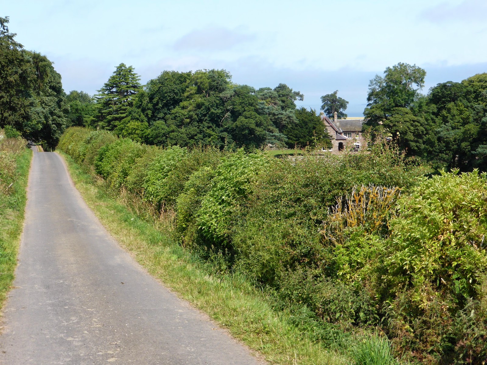
A little bit of road cycling required to get onto the next stretch of the Herring Road & the views are more familiar now.
Both Spartleton & Priestlaw hills still shrouded in fog as it slowly burns away & the sun is starting to make an appearance for the first time today as I head off road again at Johnscleugh.
Now this is something that really annoys me, people want to head either to the coast or up into the hills in the good weather for BBQ's etc & then leave all their rubbish behind !! I really can't understand the mentality of some people the coast & countryside are for all to enjoy, if they brought it then take it home again simple, leave the place as you find it !!!
Over the Whiteadder burn & up into the Crystal Rig wind turbine maintenance road, where I thought it was a better idea to push rather than suffer a puncture this far into the journey.
As I was pushing the bike up the sharp rocky road I heard a 'snap' sound just up ahead, as I got closer I could hear squealing, I then found this little weasel in one of these horrible fenn traps, the poor wee thing was still alive but had gone quiet by the time I got there, so as a former keeper, breeder & hunter of ferrets, polecats & lover of all the mustelidae family it was a horrible sight to come across & I took it out of the trap & put it to sleep.
I could of took the easy option here & kept to the wind turbine road, but I wanted to stick with route as guided by some marker poles with red tape & the occasional waymark post.
At first thought I wondered how I was going to manage to get my bike & gear over this fence but after a closer look I realised it was a gate phew !
The route through the wind farm was awful to say the least poorly waymarked, long grass 3 feet high in places, boggy ground & little hidden burns covered with reeds, you would think that the powers at be would keep a more maintained pathway even just as a gesture as they have destroyed large parts of the original route anyway.
Tough going & I could just make out the route path.
Nearly there as I catch my first sighting of Dunbar & the deep blue sea beyond.
It was nice just to have a 10 minute break having a refreshing drink as the sun beat down on me & admire the scenery that I call home.
Last bit of off road as the rest of the route is by road so again it was through a field of cows & again I think that they were just too hot to chase much to my pleasure.
Passing through the Halls farm...
...And into the village of Spott where I passed the witches stane, I never had any money on me to place on the stane as it's a local tradition, a right of passage or something I'm not exactly sure, so I placed one of the 13th coins from the treasure hoard that I came across on the SUW / Herring Road route as my offering.
Dunbar harbour at last where these strong fishwives from yesteryear would of started their journey 29 miles inland to Lauder with their creel baskets of salted Herring, I have nothing but huge respect for these hardy women as even in their day when the route would have been in far better condition than it is now it still would of been a hard task carrying 50 kg's on your back in all sorts of weather & to do this in a day is quite amazing !!
Leaving the harbour & Dunbar behind it was off home now where a coffee & bath were high on the list.
I hope you enjoyed this long post as much as I did riding it & my last thought on this route are that it's a real shame that this is not a more travelled path by walkers, runners & mountain bikers, for this being a heritage path & part of our local history I think the local councils & authorities could do more to highlight this route to tourists & locals alike.


No comments:
Post a Comment