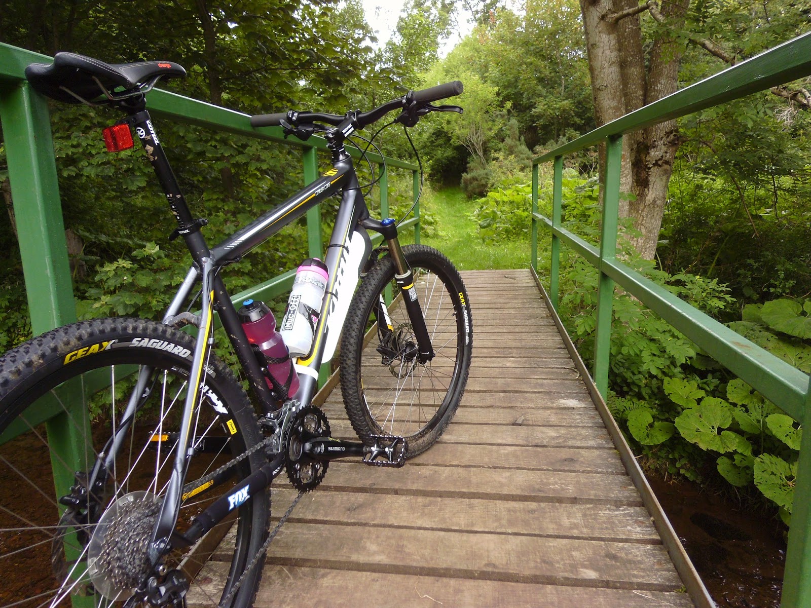
The route that I had planned for this cycle took me straight into the hills, from my home in Innerwick for approx 6 miles up, lots of lung bursting hill climbs of varying gradients taking me into the beautiful Lammermuir hills, which at this time of year the heather is in full floral bloom. Visiting the Whiteadder reservoir & Gamelshiel castle ruins along the way before heading downhill towards the village of Garvald passing Nunraw Abbey & Stoneypath Tower before heading uphill again on the way home to Innerwick... So bikers ready, pedals ready, let's go.


Elmscleugh farm, a place where I had many a good day with kind permission from the farmer to hunt rabbits with my ferrets which was great fun but hard work slogging all the nets, spades & ferret boxes up & down the hills to the rabbit burrows.


Some looking uphill & looking back downhill views climbing the what seems to be never ending hill out of Elmscleugh farm.


From farming cows & sheep to farming wind all in the same fields.


Views looking down the glens.
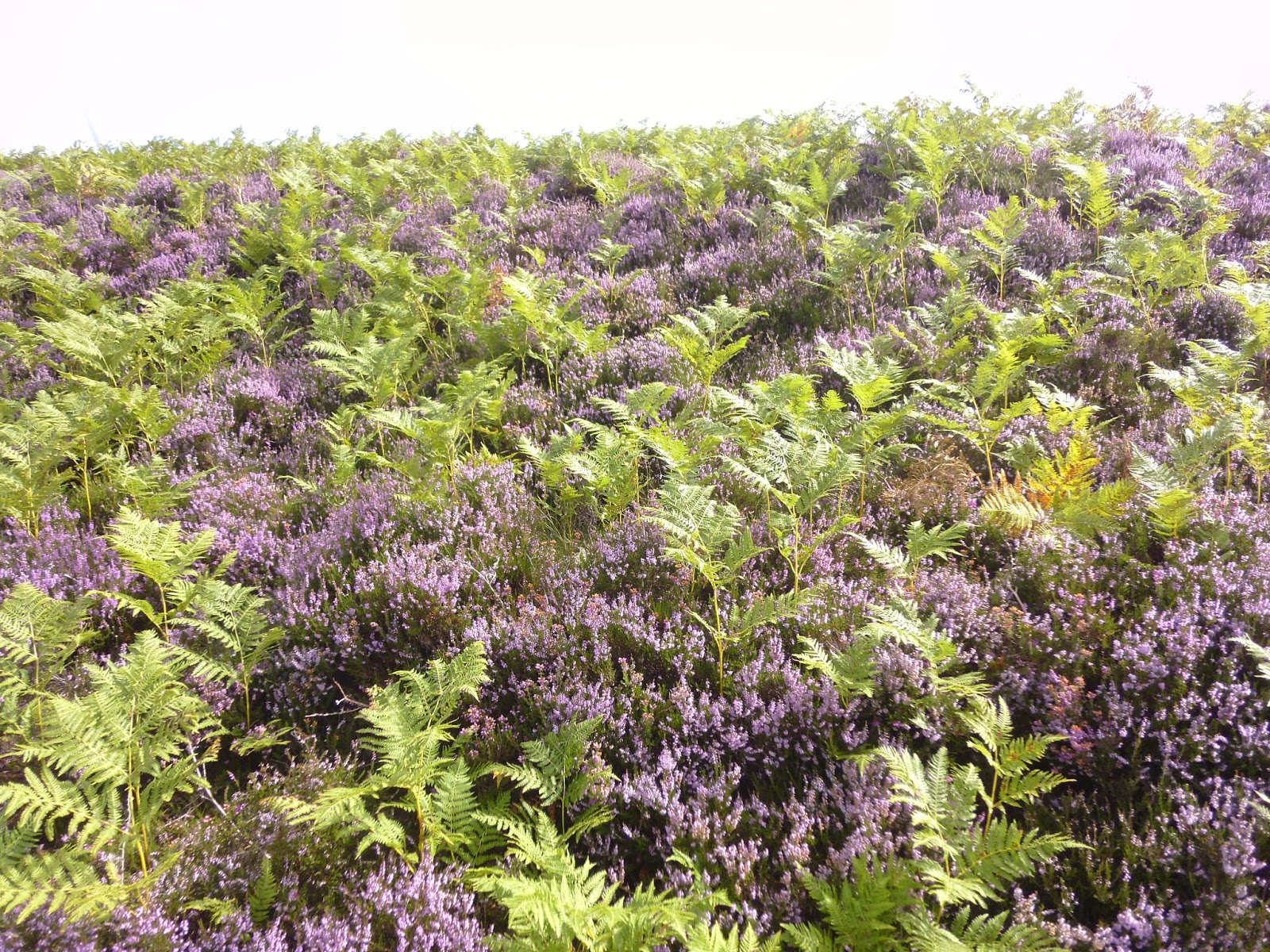


The heather showing off it's bright purple flowers carpeting the hills.

Found this wheel chair dumped by the roadside, not something that you see everyday, especially up here as it's so clean & tidy. Two back wheels for a go-cart anybody :-/


Leaving the Monynut forest & out into the open moorland with some fine views, I am now searching for a memorial I was told about in the middle of a field.

An odd looking memorial, reading a plaque on the front of it, it turns out that the monument is to commemorate 100 years of farming in this area by the Caverhill family & was built in 1904. The plaque also mentions that the last in line was William Renwick Caverhill who died in 1932, bringing the Caverhill line to an end.


Some farm scene shots around the Crichness / Bothwell area with some of the local residents standing about chewing the cud.


The Whiteadder reservoir was established in the late 1960's, the flooding ceremony was in May 1968, Millknown farm & Kingside school were flooded during this process & when the water is very low you can see the walls of the buildings. The dam is 89 feet high & 600 feet thick at the base, the overall surface area of the reservoir is 193 acres.


Gamelshiel Castle not that there is much left to see, the castle sits on the south side of the Hall burn, it is a scheduled ancient monument & it consists of the remains of a simple Tower House from the 14th century, recent studies indicate that there is evidence of a vaulted cellar. The castle was constructed from Whinstone & the sole remaining north & south walls are 4 feet thick & 20 feet high. I have read a mention that the Lady of Gamelshiel Castle was killed by wolves ! I reckon that the sheepfold in front of the castle was made from the fallen rubble from the castle ruins as there is not that much loose stone around where the castle is stood.


I found this disturbing scene while I was up at the castle, a little stoat caught in this trap, I found another 3 of these traps set up on logs as this one is & all crossing the Hall burn obviously encouraging the stoats to use the logs as access to the other side of the burn, but as a keen ferreter & having kept dozens of ferrets & polecats over the years this enraged me, so I triggered the other traps :-)
I could not figure why these traps were set here for stoats & weasels here in the middle of nowhere ?? Then it clicked as I looked about the hills, what did I see ? Grouse shooting butts, that's why these traps are set here, to catch the stoats as they will eat grouse eggs & chicks! The price to pay for a meal, but to the landowner the money to be had by big paying guns is more prosperous!!

The Herring road, I cycled this last week on my first week of my holidays with a work mate, Getting dropped off at the town of Lauder in the Scottish Borders we cycled the route over the Lammermuirs back to Dunbar, an amazing day we had really enjoyed it, unfortunately I never took enough good photos to merit a blog, but I will do it again so a blog can be done watch this space.


Shades of green & purple along the way towards the village of Garvald, the colours are superb at this time of year.

Spotted a few of these bee hives here & there along this road, looks like someone has a taste for heather honey mmm.
.JPG)
Love this photo.


Whitecastle Iron Age Fort occupied about 2500 years ago. A beautiful place with long views over the East Lothian landscape to the Bass Rock, Traprain Law, North Berwick Law, Arthurs Seat, the Pentland Hills & looking over the Firth of Forth to the Isle of May & the Kingdom of Fife.

Sitting on the Fort looking north at the stunning scenery, I could think of worse places to sit & have a bite to eat.

Old farm steadings.


Nunraw Abbey just uphill of Garvald village, no monks going about today.

Lodge house at Nunraw, an interesting looking building.


The village of Garvald a beautiful little old village hidden in a valley surrounded by trees & fields.


Passing the village church there is a sneaky little trail that leads to Stoneypath Tower.
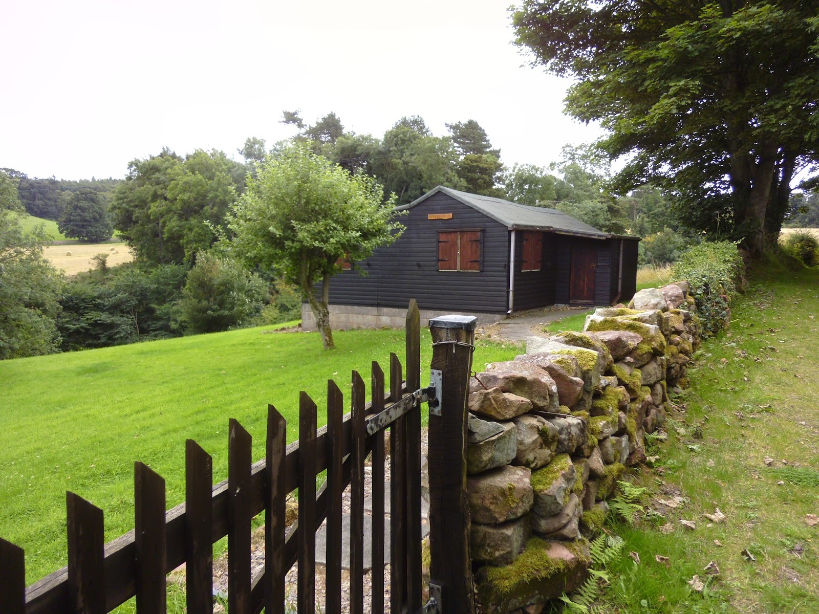
A well maintained little holiday chalet, I could live here no problem with the braw views it looks out onto.


Burnside vegetation very green & healthy with amazing aromas that always take me back to my childhood fishing for trout on the Biel burn.


 Stoneypath Tower as it was in it's heyday, as a ruin & rebuilt to it's former glory. The tower is built on a grassy ridge beside the Pappana water, there seems to be a bit of confusion as to the correct dates the tower was built some historians say the 1300's others say the 1400's. It was owned by several great Scot's families, the Dunbar's, the Douglass's on two occasions, the Lyle's, the Hamilton's & eventually the Seton's. The building is of an L-plan design with walls 9 feet thick at ground level, there is evidence to suggest that the tower suffered a large explosion at some point in history. All in all I think it's great to see old ruins like this being rebuilt to there former glory, there are so many old buildings like this that are steeped in history around East Lothian being allowed to deteriorate to rubble & over grown with ivy bursting between the walls it's a real shame.


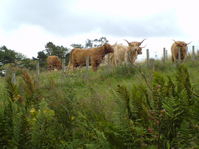 A big mean looking bull & some Highland coo's.


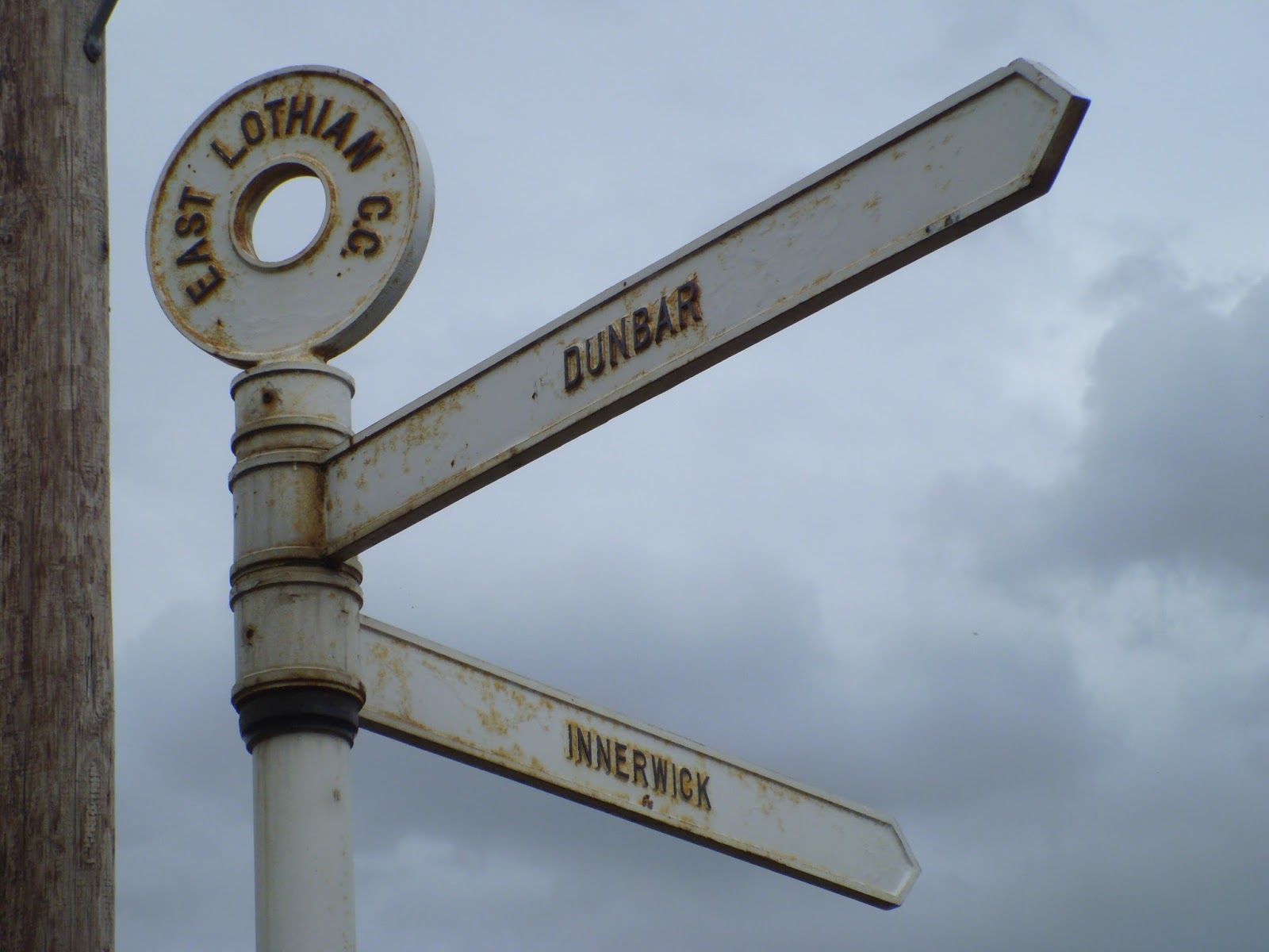
 Beautiful views looking over Deuchrie Dod hill with Pressmennan woods below on the lower slopes, & now you know why these old sign posts are called 'finger posts'.


 What a find this was for me, an old sign post just inside a gateway on the Whittinghame estate boundary wall which reads ' Private Road No Thoroughfare ', I have this odd obsession with old days sign posts, letter & telephone boxes so this was a good find, see how the tree is growing around the post at the bottom.
 'Hello' from Stenton.


 You see I told you it was an obsession !


 From the top of Starvation Brae above Spott are views of-
(Top) The river Tyne estuary with North Berwick Law in the background.
(Middle) Belhaven bay with the Bass Rock.
(Bottom) Dunbar.


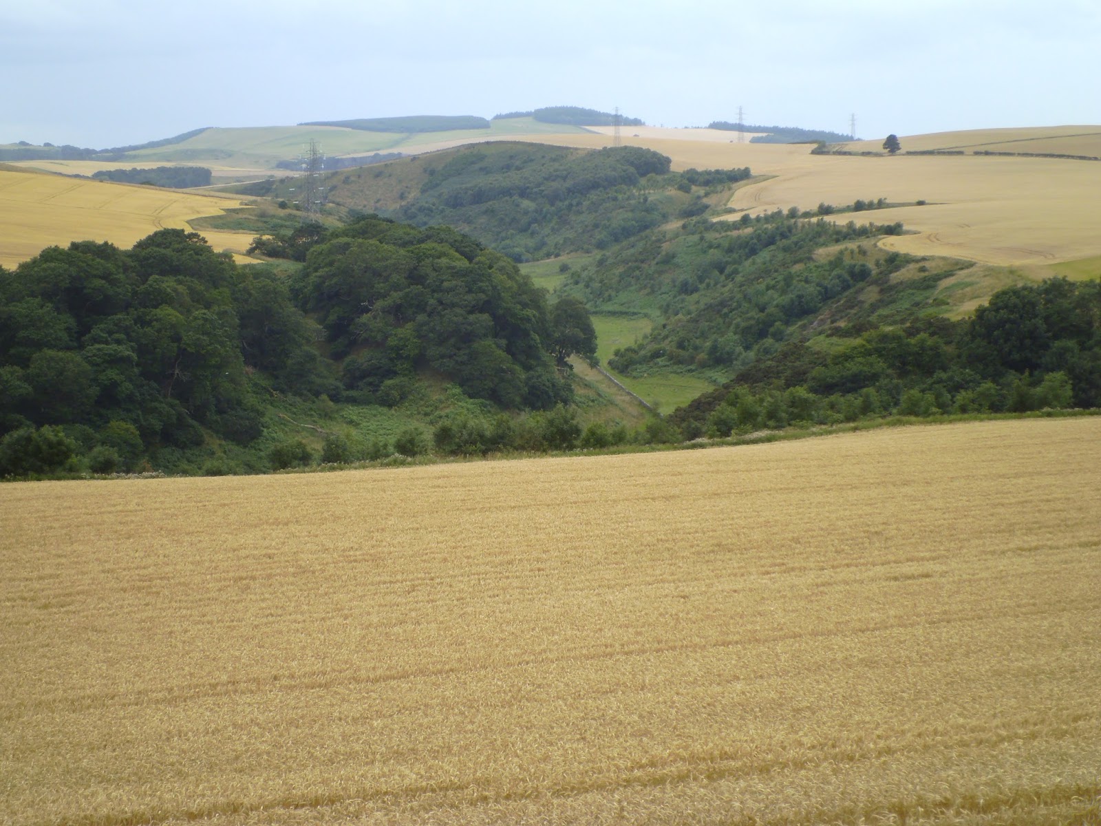
 Golden fields almost ready for cutting.


 Last of the big hills for today, climbing up the Brunt & I can smell the coffee already.
A really enjoyable cycle up the Lammermuirs I hope you enjoyed it as I did, until next time thanks for looking & bye for now.


(Top) The river Tyne estuary with North Berwick Law in the background.
(Middle) Belhaven bay with the Bass Rock.
(Bottom) Dunbar.


A really enjoyable cycle up the Lammermuirs I hope you enjoyed it as I did, until next time thanks for looking & bye for now.
No comments:
Post a Comment