The John Muir Way is a local trail starting at Fisherrow harbour in the town of Musselburgh travelling for 45 miles along the coast & across country ending in Dunglass just outside the village of Cockburnspath. The forecast was to be good for the day so I asked my wife to drop me off in Musselburgh so that I could cycle the trail home...


The start of the journey at Fisherrow Harbour.


A nice little bench based on a yacht & a look back over to 'Arthur's seat' in Edinburgh, Arthur's seat is the largest of the three parts of the Arthur's seat volcano. (Extinct)

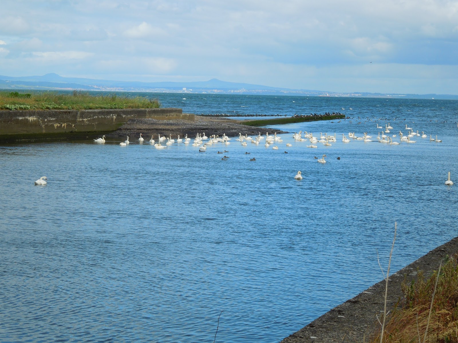

(Top) Crossing the bridge over the river Esk.
(Middle) The river Esk entering the sea with Mute Swans gathered in a flock.
(Bottom) Cloud covering Arthur's Seat.


Lots of interesting stuff crammed into this part of the JMW.

North Berwick Law to the left far into the distance & to the right of the picture is Cockenzie power station.

Prestongrange mining museum, a great look into our East Lothian mining past.


No end of information panels all very interesting looking back into the past & all about the wildlife of the area.

The first of 27 Prestonpans murals, there is a leaflet available from the library informing you about their where about's & all & their meanings.


An unusual thing to see here in East Lothian !


(Top) John Muir enjoying a pint !
(Below) One of the murals depicting the industries of Prestonpans.


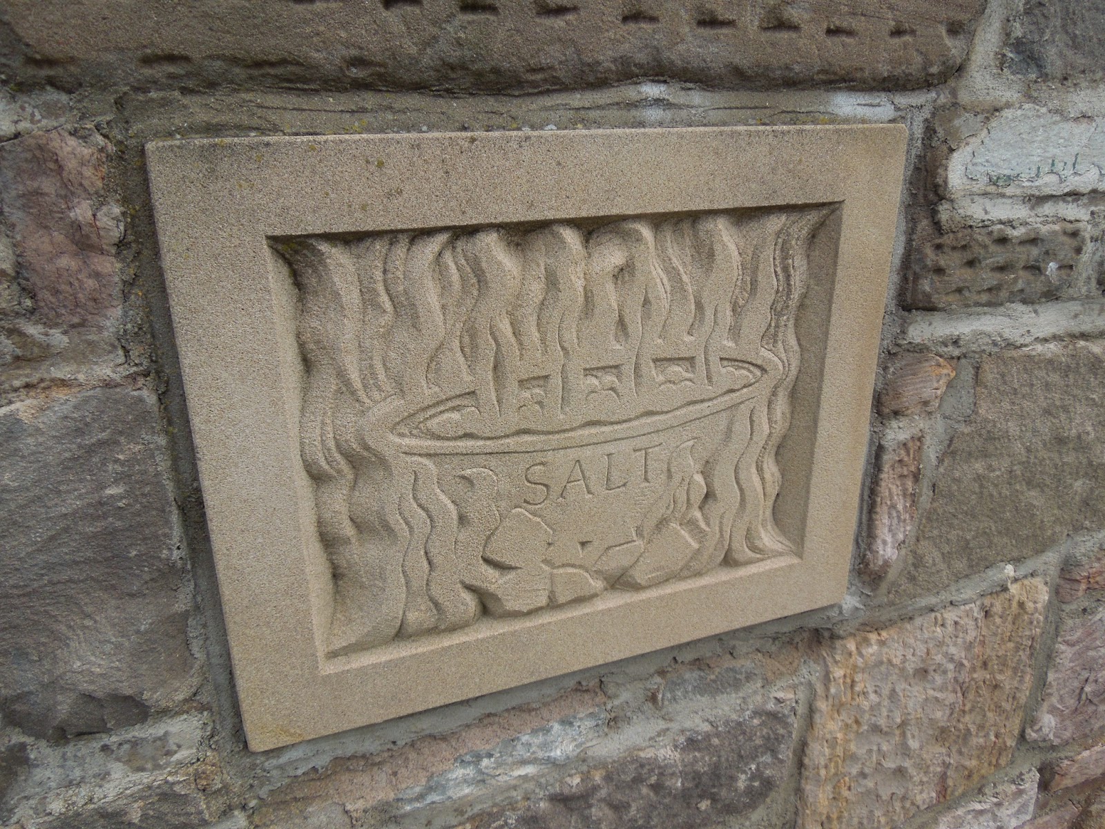
(Top) An information panel explaining salt making, the battle of Prestonpans & Fowler's brewery.
(Bottom) A sculpture by Leslie Frank Chorley.


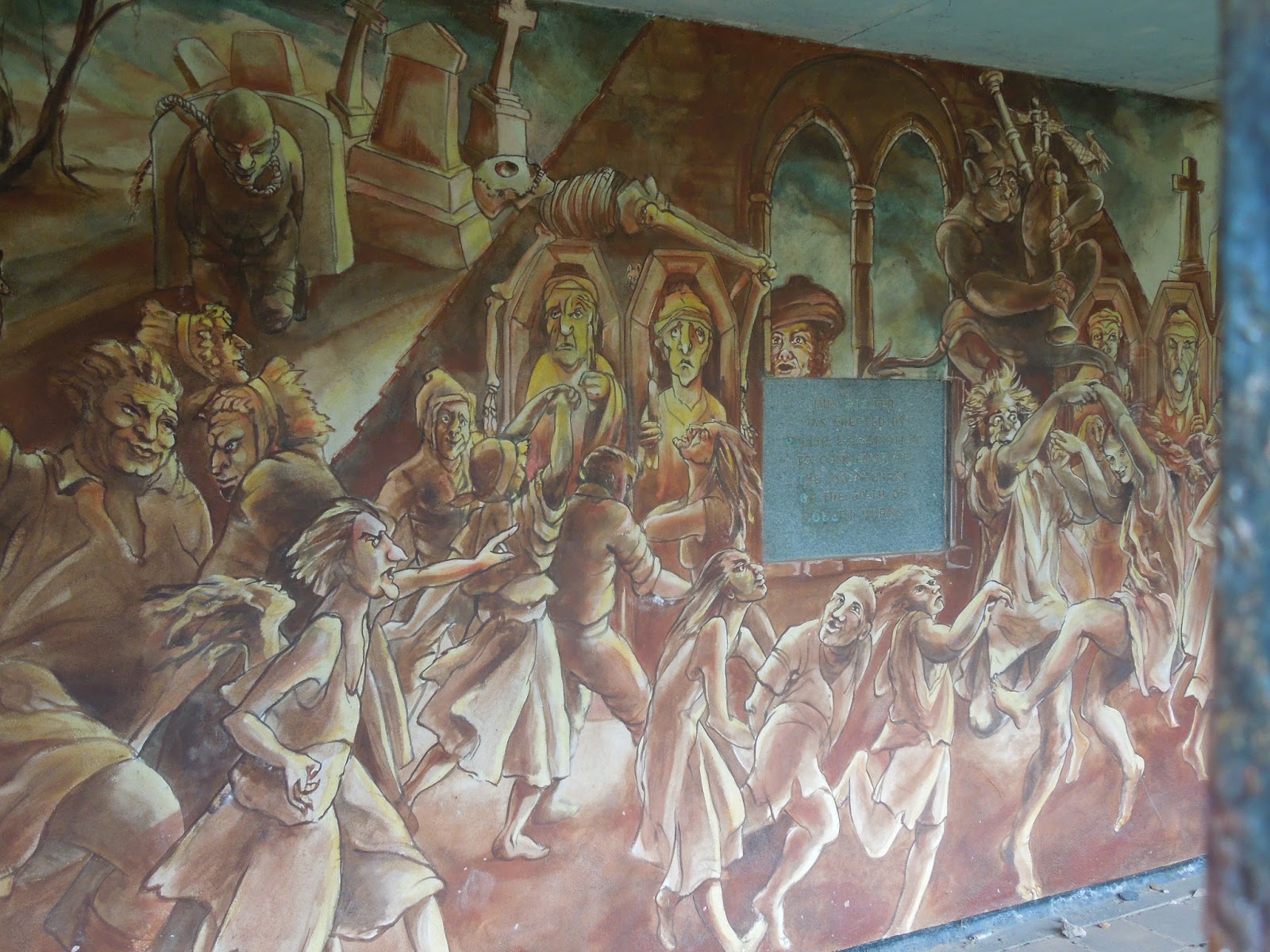


A scene of the Scottish poet 'Robbie Burns' about the poem 'Tam o' Shanter'. The shelter housing the mural was built to commemorate the bicentenary of the poet's birth in 1959.


Cockenzie coal-fired power station which closed it's doors on the 15th March 2013 after 45 years of producing electricity.


The first of many anti-tank defences from WWII that I would see all along the coastline.

In a small public gardens this monument of part of the coal grinding mill that was used in the power station the ring is 2 meters high & the grinding balls are 60cm in diameter.


Information panel & the front side view of Cockenzie.


Cockenzie harbour.


Nice carvings of harbour life built into the wall entering Cockenzie harbour.


Some nice public gardens around this part of the coast all with interesting information about the local heritage.


Port Seton harbour.


Finally leaving the coastal towns for a quieter cycle along the route.


By passing Seton Sands beach & one final look back towards the power station & Arthur's Seat.

Navigating the JMW was fairly straight forward although at some points you had to keep your wits about you as some of the signposts were hidden by trees & bushes like this one which was hidden behind some Sea Buckthorn.


Looking over Gosford Sands.


Yet more anti-tank blocks.

The imposing gated entrance into Gosford House & estate.


Into the welcoming shade of Harestane woods & lots of anti-tank blocks throughout the woods.


(Top) Scottish Birdwatchers Centre.
(2nd) The 'Loupin stane' a dignified way for short legged horse riders to mount their horse.
(3rd) Aberlady kirk the tower dates from the 15th centuary, the church being built in 1773 & rebuilt in 1887.
(Bottom) The 18th centuary 'Mercat cross'.


Just by chance I spotted this dragon made from scrap in someones garden definatley worth a photo brilliant.


(Top) A beautiful bridge crossing the tidal flats of Gullane Sands.
(2nd) A view over Gullane Sands.
(3rd) Had to get a picture of this restored VW campervan :-)
(Bottom) Banners everywhere around here advertising the 'Open golf tournament'.


Crossing the Peffer Burn & some JMW signs.


(Top) The remains of Saltcoats castle.
(Bottom) Very surprised to see these old farm buildings have not been renovated into over priced luxury accomadation considering it's location in the heart of the Scottish golf scene !


Gullane Links golf coarse.


Signs.


The stunningly beautiful Archerfield golf coarse & the JMW route heading towards Dirleton.


(Top) Dirleton kirk with a war memorial on the lawn.
(Bottom) Walls around Dirleton castle which you can just see above the tree line.
.jpg)
The majestic Dirleton Castle built around 1240.

North Berwick Law getting ever closer & Oatfield which looks as if it was an old R.A.F. station during WWII as this area is very flat & would of been perfect as an air strip ?


Information boards at Yellowcraig.


(Top) Looking over to Fidra Island.
(Middle) Broad Sands beach with Lamb Island top centre & the Bass Rock just in view to the right of picture.
(Bottom) Twisted & wind blown pine trees.


(Top) Approaching North Berwick.
(Middle 2) The JMW cuts through a Barley field.
(Bottom) A view over the Barley field towards the Bass Rock.


Some views around North Berwick taking in Lamb Island, the Bass Rock & a dedication to Robert Louis Stevenson in the town centre.


Finally arrived at & passing the prominent landmark of North Berwick Law a volcanic plug from the carboniferous period rising to 187 metres above sea level.

Nice shades of green looking outward to the ruins of an old windmill & the Lammermuir hills far in the distance.


The bottom photo of this selection shows how white the Bass Rock is, the white colouring coming from the shear amount of Gannet droppings covering the whole rock !


(Top) The path snaking through Craigmoor Wood.
(Below) One of the old fingerposts that scatter the county pointing the way.


(Top) Ruins of an old fever hospital.
(Middle) A quick look behind of the route I just came.
(Bottom) A recent addition to the JMW a small cairn at the hill summit, this was not here the last time I cycled past this way.


(Top) First sighting of Traprain Law.
(Middle) Up on top of Drylaw Hill looking over East Linton.
(Bottom) Looking East with Doonhill to the right, LaFarge cement works to the left & Drylaw Hill pigeon doocot to the below right.

An old fingerpost road sign ruined with a modern road sign stuck on top.


Water coarse entering Preston Mill & the mill itself, there has been a mill on this site since the 16th century the presant mill dates back to the 18th century & was in commercial use until 1959 producing oatmeal.


Bridges crossing over the river Tyne.

East Linton kirk & Phantassie pigeon doocot, the doocot was built in the 16th century.


Tyne side river path & tyninghame bridge.


Information board & John Muir Country Park in the distance.


More anti-tank blocks as a field boundary & the stumps of poles which are all over the beach as a defense to stop German Gliders landing during WWII.


John Muir Country Park a favourite place my wife, kids & I enjoy going for a walk.


(Top) An information board about the beach & it's past also notice in the picture the Bass Rock when it was a volcano.
(Middle) The 'Bridge to Nowhere'.
(Bottom) Belhaven Bay beach.


Now back in my home town of Dunbar following the JMW along the cliff top trail.


Dunbar Castle in ruins & how it looked back in it's day, Dunbar harbour.


Taking a slight detour up into the High Street to get a couple of pictures of John Muir's birth place & the statue dedicated to him as a young boy when he lived in the town.


Leaving Dunbar behind I head along the coast skirting Dunbar's East Links golf club towards Whitesands.


Whitesands beach & Catcraig Lime kilns.

Barns Ness lighthouse now out of use due to modern GPS, built by David A Stevenson between 1899-1901.


(Top) Skateraw beach with Torness nuclear power station in the back ground & Skateraw lime kilns.
(Middle) Fossil covered slabs of limestone rock.
(Bottom) More fossil slabs of Limestone rock & the lime kiln mid left of picture.


Passing by Torness & the neon blue water the power station used to cool the reactors, Thornton Loch beach & the last wee bit of the journey to the end in Dunglass.

& finally the end of the John Muir Way, Now for a little 4 & half mile cycle back home to Innerwick. A longer post than I intended but so many photos were worth sharing, hope you enjoyed it & thanks for looking.

John Muir
21/April/1838
24/December/1914.
No comments:
Post a Comment